As an architect & urban planner my principal concern is to make cities work for people. This means understanding how their streets connect to either encourage low carbon transport such as walking and public transport. Or, if they’re disconnected, do they lock in car dependence and its carbon impacts?
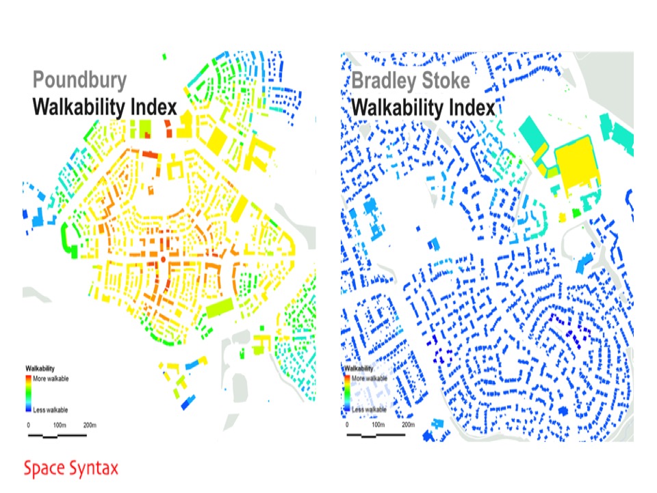
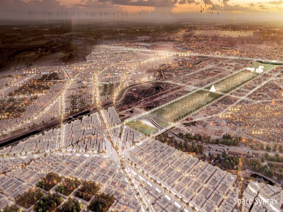
At my company Space Syntax, we’ve been developing Smart Cities computer modelling techniques for over thirty years, to understand the deep structures of cities so that we can then plan them better. Recently we published a Walkability Index that describes whether existing or new development is going to work.

Connected, walkable streets are not only good for reducing carbon – we’ve also understood they are good for commercial real estate, retail performance and job creation.
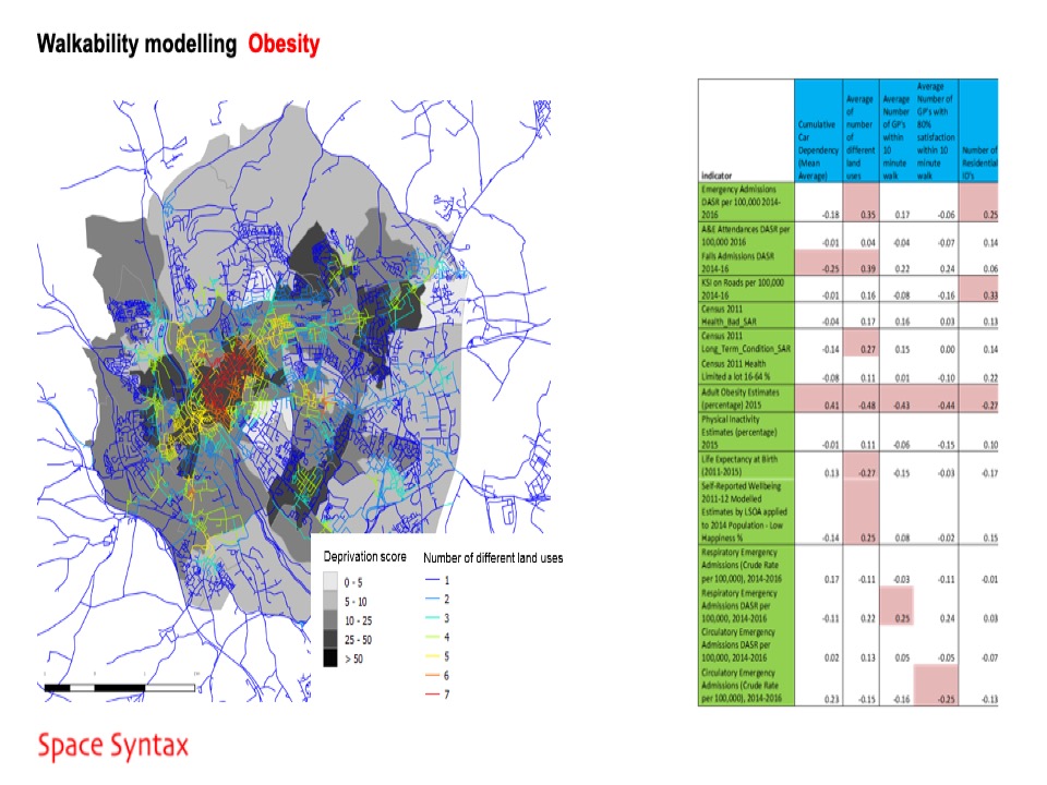
Computer modelling of street connectedness, combined with statistical analysis of public health, has also revealed important impacts on health. People are more likely to be obese in places that are less connected because these places encourage less walking, and less overall physical activity.
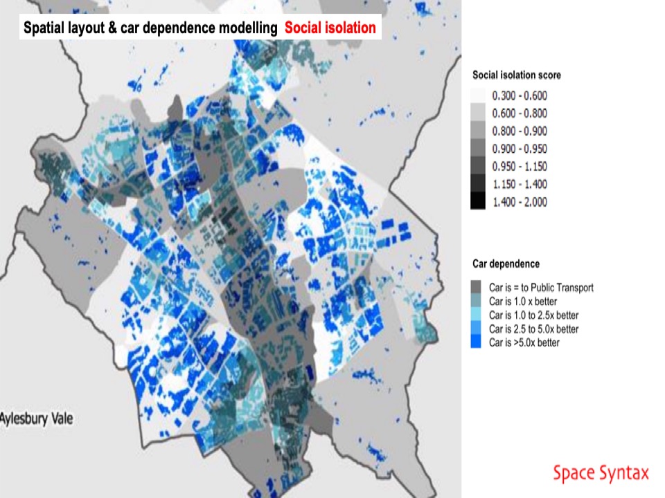
And not only physical health but mental health too. Following an interdisciplinary approach we have worked with health and care agencies to understand how people report being lonelier in less connected places. Why? Because less connected, less dense places make it harder to form social networks.
So, bringing these findings together we can plan and design cities as systems of systems, allowing us to integrate land uses – so people work closer to where they live, integrating transport so people can walk or take public transport and avoid reliance on cars.

We’re using agent-based models to plan cities as networks of streets, parks and public spaces – heavily planted with trees to create shade to the benefit of people walking as well as to the biodiversity of non-human species.

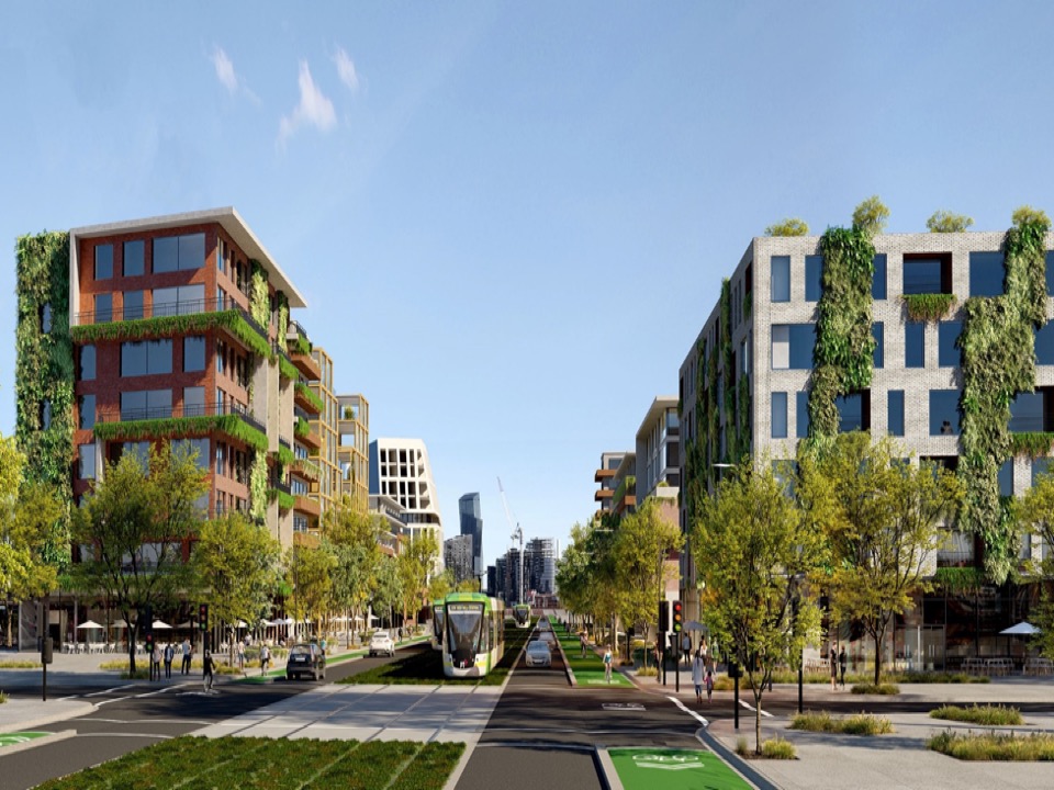
And if I can focus on one key element it would be the walkable main street – we have allowed our main streets to become dominated by fast traffic. Instead we need to redesign them for slow speed movement. Yes, still for private vehicles but also for walking and cycling.

So when my clients ask where to start to think through the complexity and apparent chaos of cities, I encourage them to start at the street. Think of streets as places for people.

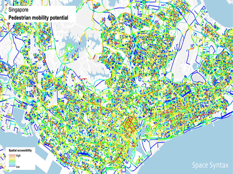
And of course Singapore has all the potentials to be an ever more walkable nation. Computer modelling of street connectedness is allowing us to identify exactly where these potentials are and where they can be created through new planning and design.
How do cities respond to COVID-19?
Ventilation is changing the form of cities:
- opening windows
- opening up the ground floor
- seats in streets.
What will the future city look like?
How to design the future city…
Study history – long history – how villages become towns become cities.
Some emergent trends…
Shade
Flooding
Slow speed
Streets
Localism.
A tweet to summarise
Think of a city as a “transaction machine”, helping people flow effectively and to come together in streets, parks and public spaces for the social and economic interactions that will drive the innovations that will shape a better future.

Leave a comment