
Until a vaccine is found for COVID-19, and perhaps beyond, it will be important to practise physical distancing in towns and cities.
Whether this is possible will come down to the “carrying capacity” of the urban infrastructure: in particular, the relationship between Pedestrian Supply in the form of sufficiently wide footways and Pedestrian Demand in terms of the need for people to walk, whether that is to work, home, school, the shops or for leisure and pleasure.
Both supply and demand are calculable using tools from tape measures to multi-variable modelling algorithms.

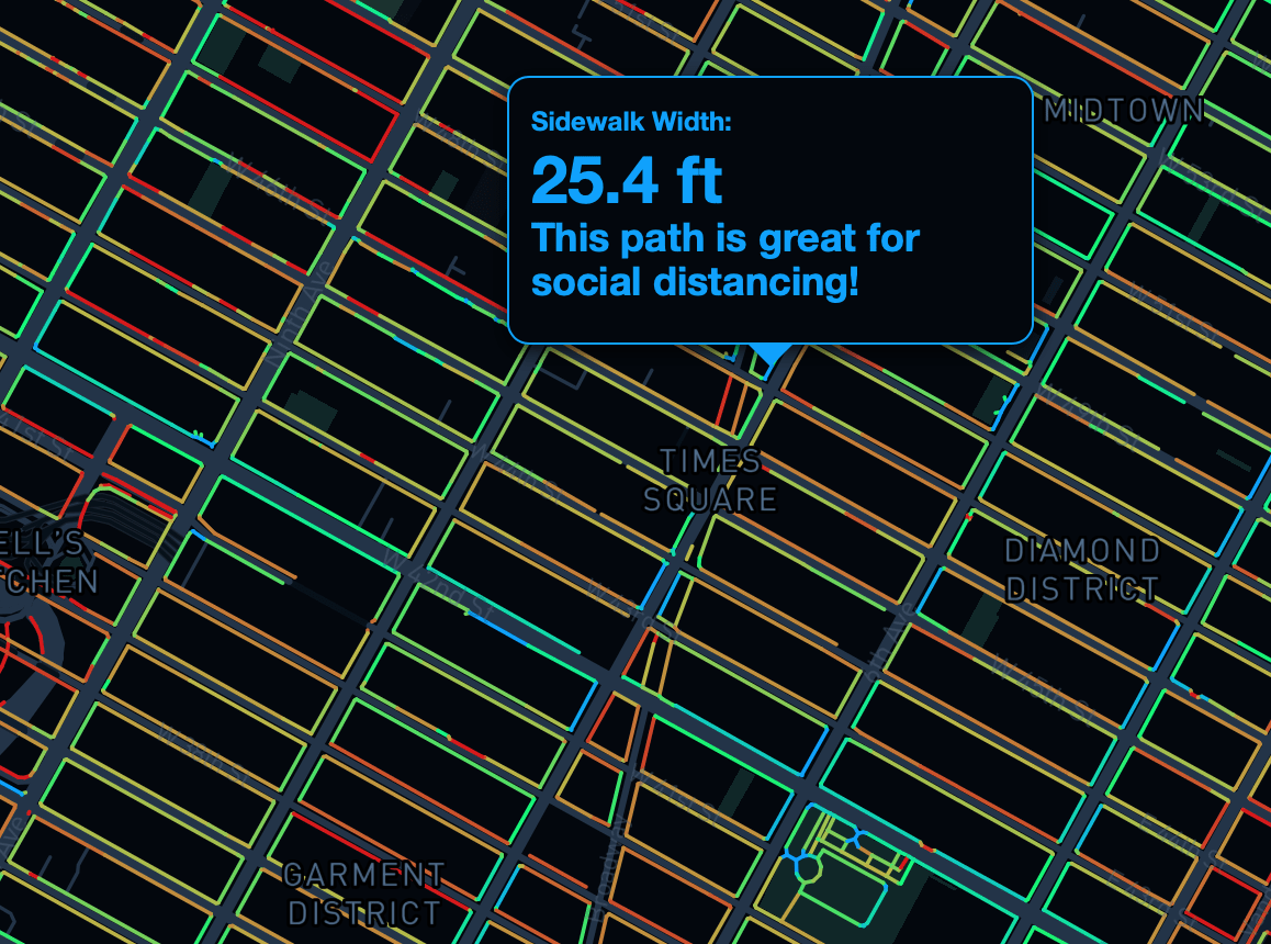
Much well-deserved attention has been paid to the Sidewalk Widths NYC project, a digital map that “is intended to give an impression of how sidewalk widths impact the ability of pedestrians to practice social distancing.” By measuring the available width of footways, the map indicates which footways may or may not be suitable for physical distancing.
Sidewalk width provides an important piece of the “Pedestrian Supply” equation. However, it is not on its own capable of answering the central question: is physical distancing possible?
First because it is a one-dimensional measure and physical distancing is at least two-dimensional: it may be possible to keep 6 feet to the side of someone else, but is it possible to keep 6 feet in front and 6 feet behind? Given the length of many streets in New York City it may seem apparent that there is plenty of space to go around but the generously wide sidewalks of Times Square demonstrate that, under normal circumstances it is possible for these to be swamped with human activity and, as a result unsuitable for physical distancing under the new normal. Furthermore, it may be possible to observe distancing while walking mid-block but what happens at street intersections? Is there space to queue? Are the street lights synchronised to let one “platoon” of users cross before the next arrives behind them? Is flow predominantly one-directional (which it may often, but not always, be in the rush hour) or two-directional (as it can be at lunchtime)? One-way flows may have less of the “ordered chaos”, the urban ballet of two-way flows and so one-way flows may be more efficient.
And this speaks of the second factor that needs to be taken into consideration, which is the “Pedestrian Demand” placed on the walking infrastructure. Where are people moving from and to? And at what volumes? What local attractions are there – such as the naked cowboys of Times Square – that might cause them to stop and dwell.
Many of the wider streets and avenues in New York, or any town and city, will not be suitable because they have higher levels of Pedestrian Demand than can be satisfied by the Pedestrian Supply ie if the “Carrying Capacity” of the footway is exceeded.
We have been investigating the relationship between pedestrian supply and demand for many years at Space Syntax, building pedestrian behaviour models that connect together data on a) the physical urban space of towns and cities, b) their land use attractions, c) their transport infrastructures and d) their demographic patterns of eg health and wealth. Integrated Urban Models address mobility issues as well as other socio-economic performance measures.
We are currently looking at how towns and cities will need to adapt to the physical constraints placed on them by COVID-19 including:
– the various short-term options for creating suitable conditions either by a) reducing Pedestrian Demand by restricting the number of buildings that are allowed to reopen or by restricting the number of people per company that are allowed to return, or by b) increasing Pedestrian Capacity by widening footways and reducing roadways, and
– the longer term opportunities for bedding in these “emergency” changes in the form of permanent transformations eg slowing traffic down, making one-way fast roads into two-way, slow-speed, walking and cycling-friendly streets, with street trees and parklets.
Each city will be different but the essential design elements are low-cost and “shovel ready”. The hard-fought case studies are there, from Amsterdam to Melbourne, Paris to Medellin, Trafalgar Square to Times Square. These demonstrate the effectiveness of the measures.
What will make the difference between one city and the next, one nation and another, is brave political agency, supported by the bold imaginations of public realm designers and the supportive analytics of organisations such as Space Syntax and the Sidewalk Widths NYC project.

Leave a comment