In the field of traffic planning, pedestrian movement is often the forgotten transport mode. But the reality is that pedestrians are the most important mode – because it is when we are pedestrians that we are closest to the places where we make money and spend money; when we are most healthy and, above all, when we are most human.
Blog
-
The two types of Smart City technology
There are two kinds of #SmartCity technology. “Smart at” and “Smart from”. Which is yours?
Smart at
Here’s our technology. We developed it for another purpose (often agriculture or aerospace). We’re not sure if it really works in cities but we hear that cities are a big market and we’re prepared to have a pop.Smart from
Here’s our technology. We developed it through rigorous research on cities: their current conditions and their future needs. We did this because we recognised the importance of cities some time ago. We’re delighted that the rest of the world has now drawn the same conclusion.
NB “Smart at” has derivatives eg “We developed this technology for cars because cars were the “be all” and “end all” of urban policy. But now we’re told that bikes and pedestrians are top of the pile so we’re repurposing it and rebadging it for them. We hope it works but we’ve no research to show it does.
“There is nothing in the world that some man cannot make a little worse and sell a little cheaper, and he who considers price only is that man’s lawful prey.”
John Ruskin -
Urban | Auckland ideas
Inspired by Richard Saul Wurman’s presentation at the NZPI Annual Conference 2015 & discussion afterwards.
ScalesLocal places are made by virtue of their place in a wider setting. Squares: it’s not the local design that makes the difference, it’s the connectivity with the wider city that matters.Patterns – common languageSpace Syntax focuses on the common language of space. Seeks to identify the patterns within that language.Future thinking frameworkClimate changeResource securityDemographic change1. Living in cities: live, work, leisure, innovation.2. Governance3. Infrastructure4. Metabolisms5. Urban form6. Financing7. Technologies8. Scenarios – investigating the importance of oppositesMisunderstood citiesWe don’t understand the complexity and the interdependencies of cities. The Science of Cities is nascent. There’s much to learn.Urban data analystThe job of the century.Geoffrey West1. Every city should have a vision2. Every city should have great leaders.ComfortIt’s less about being complacent when feeling comfortable. More about using that feeling to be creative. Mastery.Products. Process. Performance.We tend to focus on the product.3 kinds of technology:DigitalPhysicalIdeasTechnology to:1. Analyse2. Present -
Creating a cultural database
 Sir Tipene O’ReganMāori indigenous local and world viewsNotes on the creation of a cultural database using digital technology, presented at the NZPI Annual Conference 2015.“Culture needs to be cultivated.”“We must remember to remember.”“People who have no memory have no future.”Cultural mapping – “Stories of death, lust, more lust & bravery”. Google Earth database of >4,000 names with historic references. Songs, stories too.“We have to be the proprietors of our own cultural database.” This applies equally to any community as it does to the Māori culture that inspired the sentiment. “Something that is authentically ours with an authentic base”.“Walk into the future with your eyes on the past.”
 -
Attracting new industry to cities – acting beyond the obvious
I was at a meeting in London yesterday with visiting Chinese national policymakers and was asked what was needed to attract a new industry to a city.This is an important question not only in China but in any country where cities are trying to encourage new business growth. In answer I suggested that there were three important factors that needed to be in place:1. Distinctiveness – the USP of the city – what makes the place special; its climate and its culture. Each city needs to be able to tell its own story.2. Universities and other educational resources – to act as partners to industry to drive innovation and provide a skilled labour pool.3. Great streets and public spaces – after all cities are about human beings needing to move around efficiently and also to enjoy being in the place where they work.Of course other factors are important: a reliable supply of energy and other services; sites that are ready for development and effective legal processes. But these are the obvious consistencies.Cities also need to focus on their story, their academic partnerships and the quality of their public realm: factors that can be neglected in the push to attract new business. -
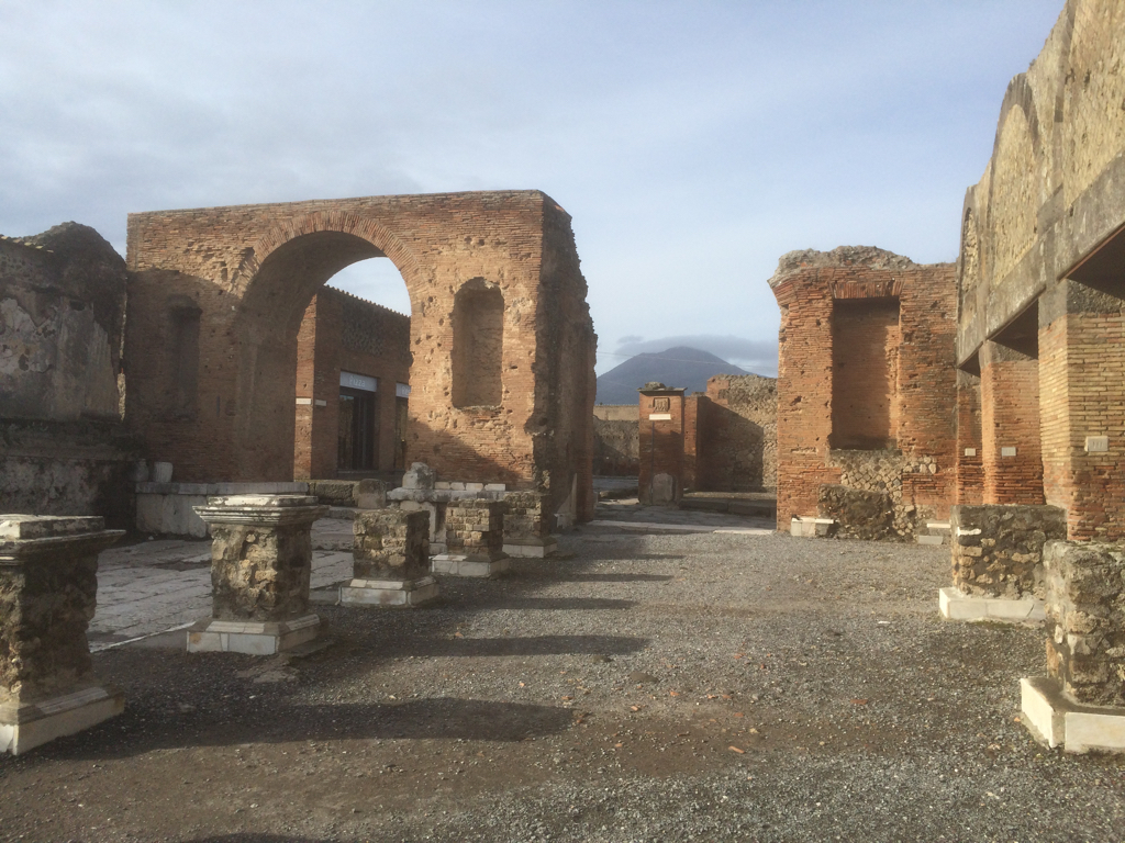
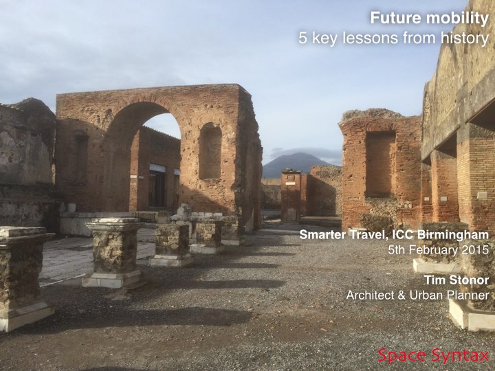
What did the Romans ever do for us? Pompei’s 5 lessons for placemaking…

In looking forwards it is important to learn the lessons of history.
Look at Pompei. A city built for efficient mobility.
A model of the 1st century with lessons for the 21st century.

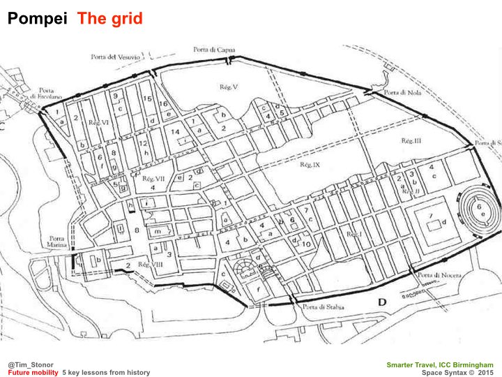
The grid – no cul de sacs. Built for mobility. Built for commerce.
More or less rectilinear – not labyrinthine. A layout that brains like. Easy to wayfind. Hard to get lost in.

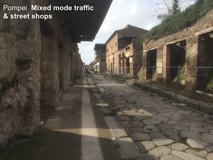
A Main Street with shops – no inward-looking shopping malls. Active frontages. About as much surface for pedestrians as for vehicles – the right balance for then. Perhaps also for now?

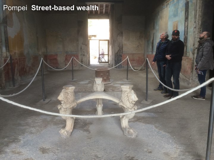
And shopkeepers of great wealth! It was not a compromise to open onto a Main Street. It was a sound commercial investment. Who would turn their back on the flow of the street?

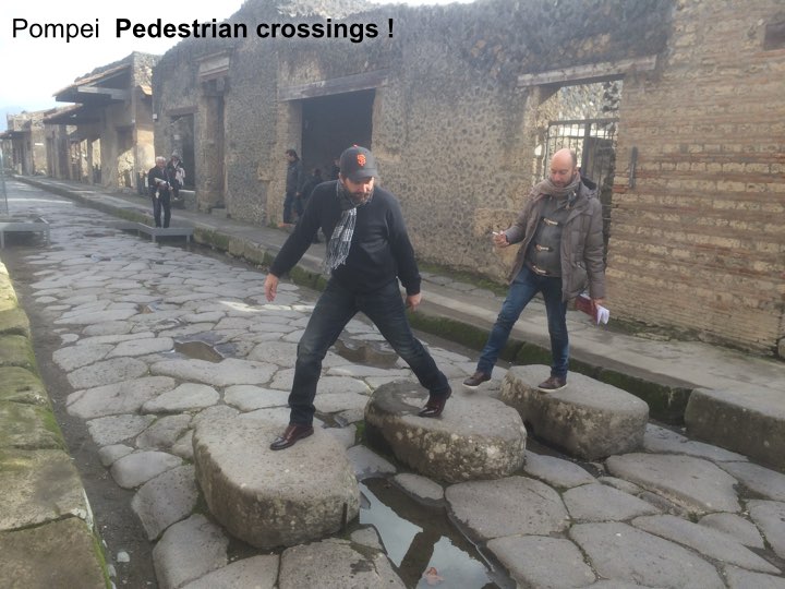
Pedestrian crossings! The deep kerbs channel water when it rains, flushing the dirt from the road and keeping it clean. Integrated infrastructure.

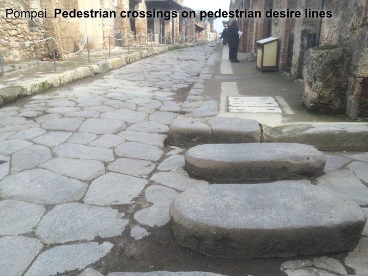
Pedestrian crossings that are aligned with pedestrian desire lines – not following the convenience of traffic engineers’ vehicle turning arrangements. Pedestrians first because its the pedestrians that carried the money, not the vehicles.

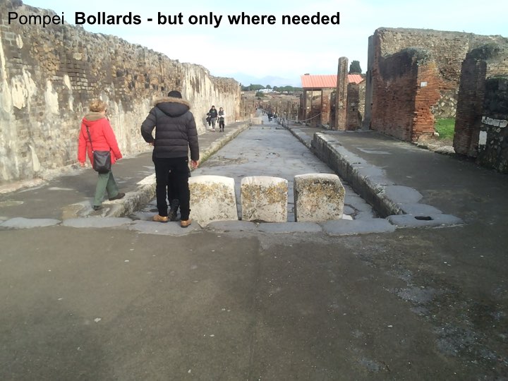
A small, pedestrian only zone in the very heart of the city. No bigger than it needs to be…

…unambiguously signed that this is where you have to get out of your chariot and onto your feet.

Pompei: a city of great streets – great street sense.

But in recent times we lost our street-sense.
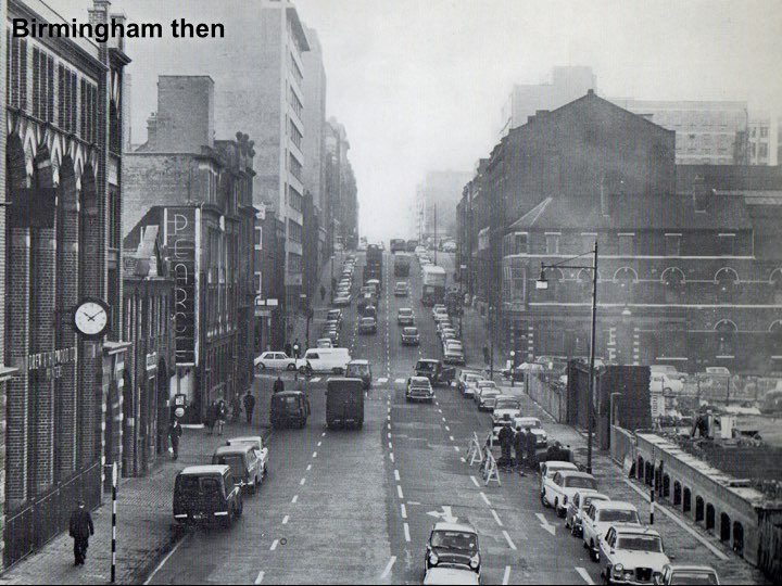
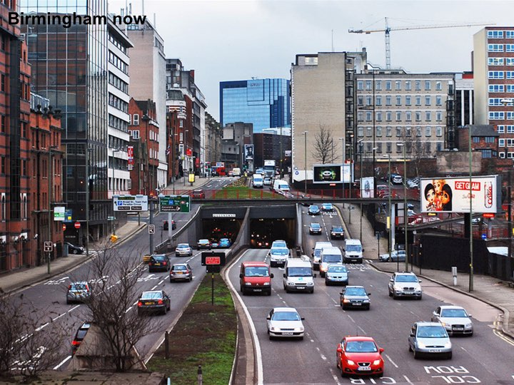
Look at Birmingham then…

And now. What happened to our street sense?

And Birmingham was not alone.
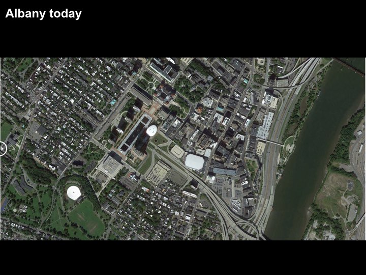
Look at US cities:
What they were…only 60 years ago – recognisably like Pompei: simple, rectilinear grids.

Then what they became…
We became entrapped by traffic models.
And a love-affair with the car.
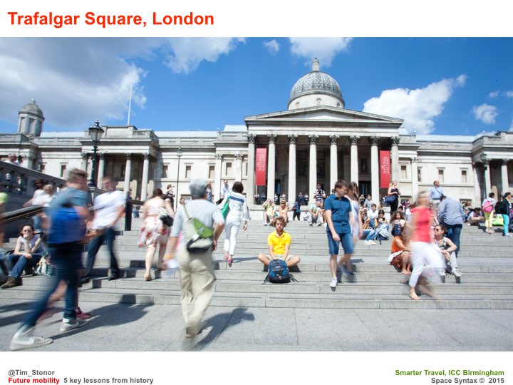
We need to regain our street-sense.

Fortunately this is happening.
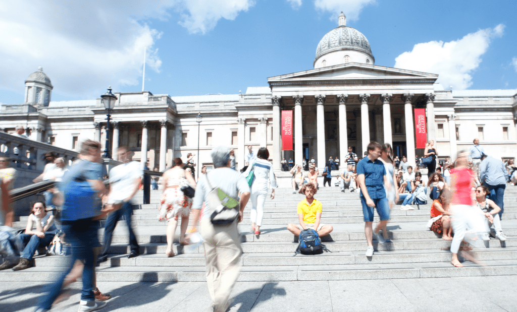
Trafalgar Square,
Nottingham.

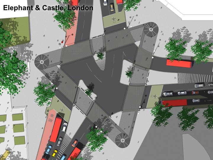
At the Elephant & Castle, this design puts the pedestrian crossings on the pedestrian desire lines – just like those crossings in Pompei. We’ve talen pedestrians out of subways and given them their proper place at street level, next to the shopfronts. We’ve made the humble crossing an object of beauty, spending many different budgets (landscape, planting, pedestrian, cycling, highways) on one project so that each budget gets more than if it had been spent separately.

This new approach – a rediscovery of street sense – has been made possible through advances in science that have made us see the errors of previous ways.

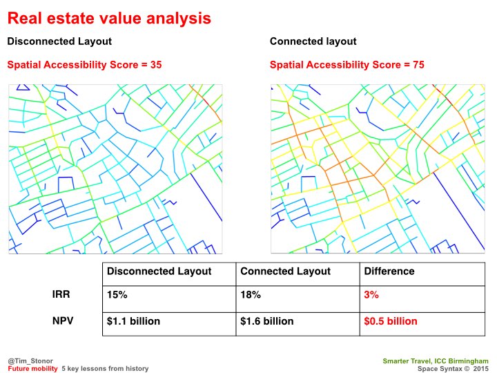
The more we look into this the more we find of value: for example, how connected street grids create higher property values in the long run.

And Birmingham has pioneered this science:
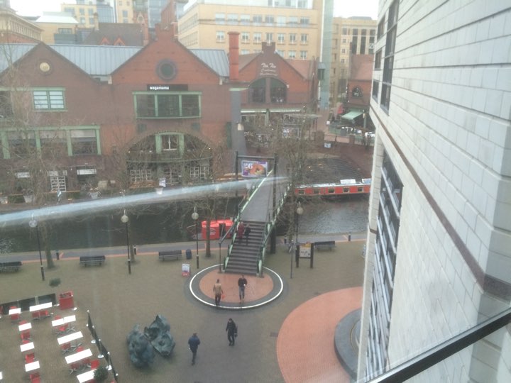
Brindley Place – the bridge on the straight east-west route – a lesson from Pompeii! It may seem obvious today – because it’s a natural solution – but it wasn’t obvious to some people at the time, who wanted the bridge to be hidden round the corner because, they said, there would be a greater sense of surprise and delight! What nonsense. We had to model the alternatives and show just how powerful the straight alignment was.
We still have to do so today. Many urban designers and transport planners have been slow on the uptake. The average pedestrian gets it immediately. What does that say for our professions?

Now cities all over the world are recovering their street sense, creating plans for their expansion that are street-based, not mall-based.

In time to accommodate a new, two-wheeled chariot: the bicycle.

SkyCycle – a new approach to urban mobility. Creating space for over half a billion cycle journeys every year. Constructed above the tracks, allowing smooth, predictable, junction-free movement between edge and centre. Developed by a consortium of Exterior Architecture, Foster + Partners and Space Syntax.
Adding to cycling at street level – not taking it away.

Recently, at the Birmingham Health City workshop,a discussion about the location of healthcare facilities quickly became one focused less on hospitals and wards and more on streets and public spaces. On “free”, preventative public health rather than expensive, clinical curative care. Free in that it comes as the byproduct of good urban development.

Rob Morrison’s drawing of the Birmingham Boulevard…

…an idea to turn the Inner Ring Road into an active street.

And to achieve this there are clear principles to follow:
1. Connected street layouts.
2. Mixed mode movement – not separated by tunnels and walkways.
3. Active streets ie lined with street shops not mall shops.
4. Pedestrian crossings on desire lines, not where it’s most convenient for traffic turnings.
5. Limited pedestrianisation of the most important civic areas.
A thought – yes Pompeii was a city of commerce but the houses of the city are filled with references to literature, poetry, music: the arts.
Huge cultural value.
After all, this is the important, aspirational aspect of living in cities that comes with the efficient mobility that results from pragmatic planning: the grid, mixed modes, active frontages on main streets and special, limited, high intensity, pedestrian only places.
When we get this right we have time to truly enjoy ourselves in the arts and sciences. In culture. That is truly great urbanism.
-

The Garden Street – the essential, unspoken element of the Garden City
Too often the Garden City is visualised as a place of huge green spaces enfolding small pockets of grey streets. The green and the grey.
But why should streets be grey? What about avenues? Boulevards? Rows of trees? Grass verges? Street planting at various scales.
And don’t those huge green parks just separate the urbanism? Don’t Green Parks create barriers between people and opportunities? Between homes and jobs and places of leisure?
The city of the future should be a city of green streets as well as green parks? And, if we wish to call it a Garden City then we should remember to include the Garden Streets as well as the Garden Parks?
After all, they were always part of the mix.

-
Open data needs open attitudes
Tim Stonor speaks at the Building Research Establishment about his experience using data in the planning and design of buildings and urban settlements.
-
Technology by necessity
Notes for today’s talk at the NLA’s conference on “How do we build a smarter London”
The London context:
– more people (growing population)
– more data (sensors everywhere)
– more sophisticated computing.Strategic problem: how to handle it all.
Space Syntax’s experience: address the problem via “the questions of reality”.
The commercial application of Space Syntax research was catalysed by approaches from London residents in the early/mid 1980s eg Limehouse Basin, South Bank, King’s Cross: citizens groups opposing property developments they saw as being alien to London life. Today we work for those developers as well as community groups. Developers have learned to “get it”.
Data and computing create an art of the possible (sometimes the seemingly impossible too eg the wonderful Pigeon Sim). Pass the art of the possible through the filter of reality/market demand. Then it’s possible to make sense of it all – to know what to do.
The questions asked by our clients are the necessary filter.
Then evolve the technology according to new and difficult questions.
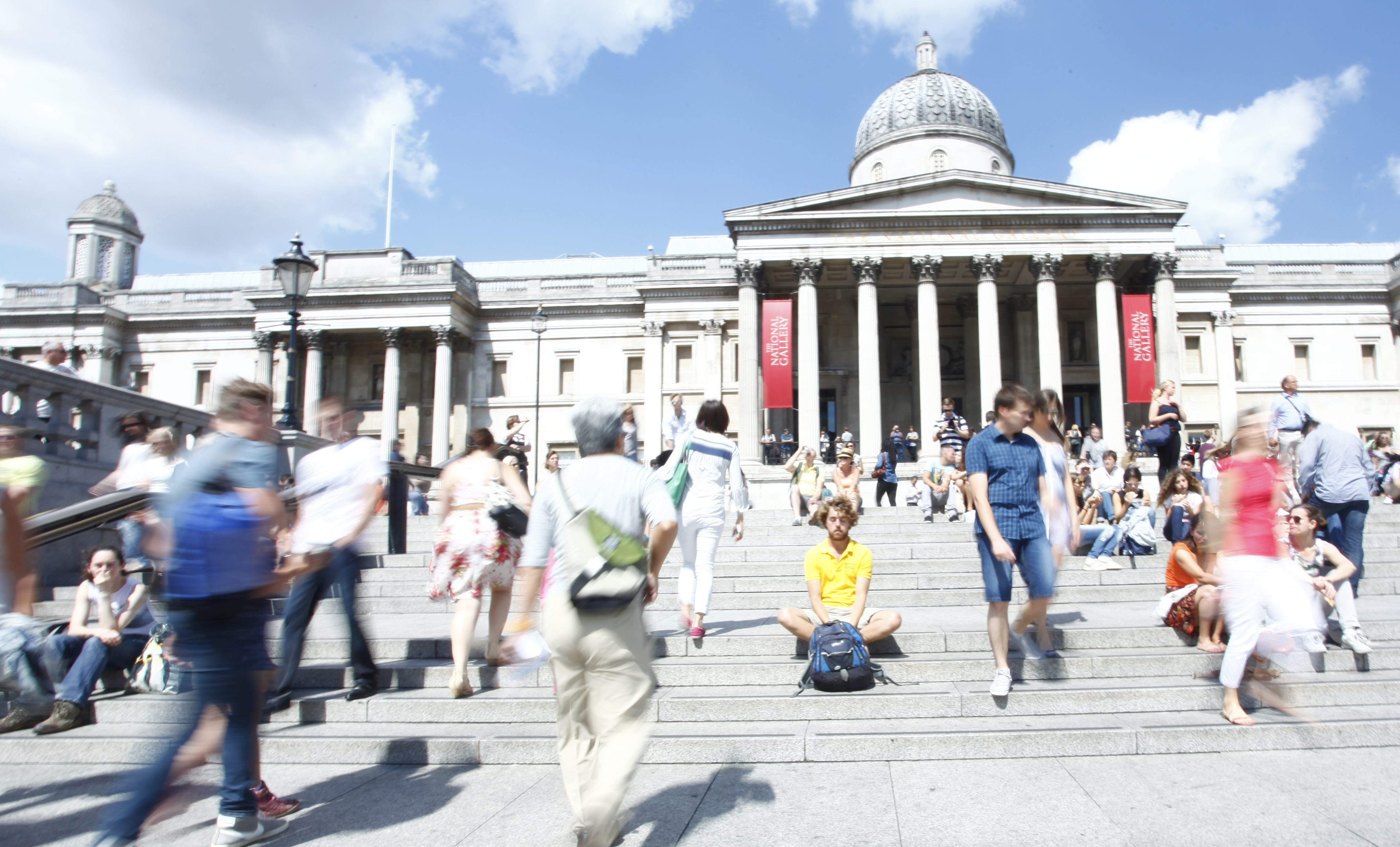
This is what we had to do to understand Trafalgar Square – we’d never studied such a complex open space before.
Technology by necessity.
-
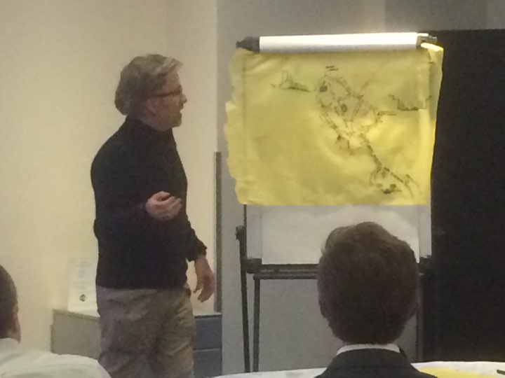
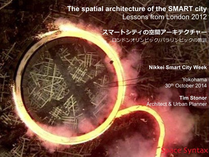
The spatial architecture of the SMART city

Good morning. It is a pleasure and an honour to have been invited to give this presentation today at the Nikkei Smart City Week conference. The subject of my talk is architecture – not only the architecture of buildings but, also, the architecture of public space: the space that we move through and live our lives in; the glue that binds us together.

In the first part of my presentation I will address three key questions:
First, what is a Smart City?
Second, how can a Smart City be planned & governed?
Third, where is the place for technology in the Smart City?
And I will relate each of these questions to the architecture of space.

In the second part of my presentation I will describe the very significant effort that the UK is making to plan for its urban future, embracing the opportunities that new technologies provide.

In the third part of my presentation I will describe the use of computer modelling techniques in the creation of the London 2012 urban masterplanning process. (more…)
-
Defining Smart(er) (as) Cities
I prefer the term “Smarter City” to “Smart City” even if it has already been claimed by IBM.
“Smarter City” suggests the city is already smart and technology can make it smarter, whereas “Smart City” can be misinterpreted as suggesting that the city is dumb and technology, like a White Knight, will ride to its rescue.
And in truth some cities are dumb – or have been made dumb by modern transport planning: choked with congestion in pursuit of car-based sprawl.
But not all cities are dumb. We have cities for a reason. They are fundamentally smart in the way they create intensification of opportunities for people to meet, interact and transact. In this sense, cities are a natural product of human evolution.
To be truly smart, cities need to recognise their fundamental smartness. Real cities – the places that resonate to the “urban buzz” – are already smart cities. Historic cities, unsullied by destructive modern planning, are smart cities. Low technology cities, if they are compact and people-focused, are already smart cities.
Future cities need to be as smart as great historic and low technology cities.
Smart City – good.
Smarter City – better.
Smart as Cities – best!
-

A new science for cities
A talk given to the Leaders and Chief Executives of the Key Cities, Brighton, 24th October 2014.

We hear a lot about smart cities as the solution to the needs of urban places. But although technology allows us to live remotely and speak to each other from deep forests and mountaintops, humanity as a species has become more and more urban. The more that we could be apart, the more we have actually come together.
Perhaps we need to understand that smart cities is not a new concept: cities were always smart – if they weren’t smart we wouldn’t have them. (more…)
-

Bill Hillier’s Smart London
Notes of Bill Hilliers opening talk about the NLA Smarter London exhibition, 8th October 2014.
Congratulations to the NLA and CASA for the exhibition.
It’s evidence that London is the original smart city – nowhere such a collection of top class practices, imaginative authorities and academic departments developing new ways of doing things, and new technologies –and talking to each other !
But I think London is a smart city also in another sense – the city itself and how it’s put together.
When I was young London was regarded as an unplanned mess, in need of being tidied up into a system of well-defined neighbourhood units separated by main roads – a bit like Milton Keynes.
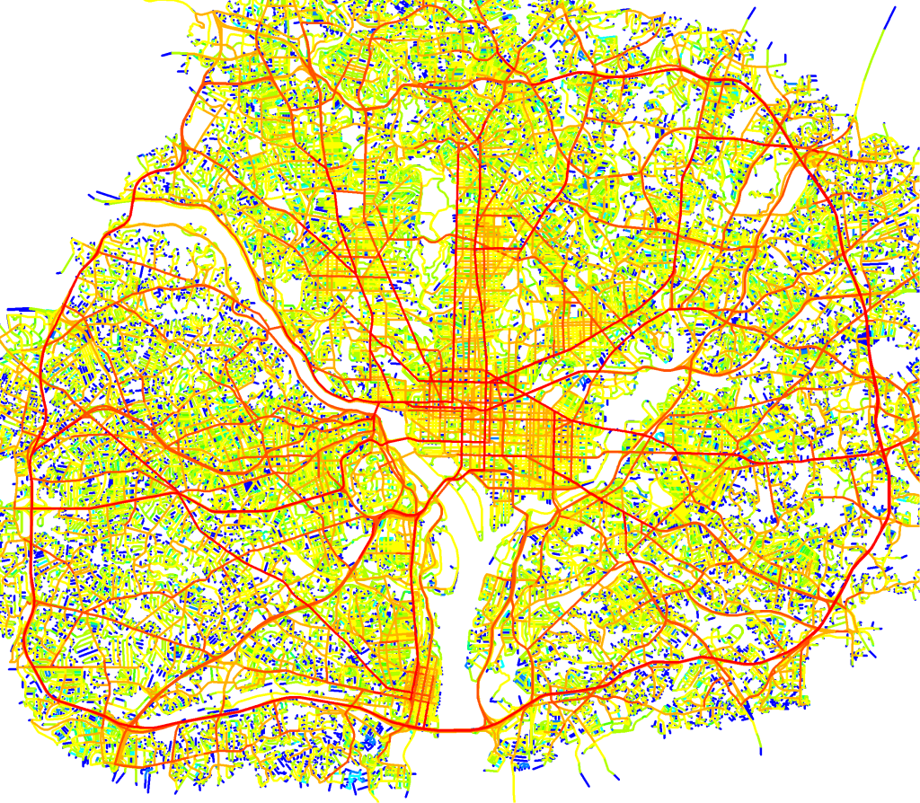
I’ve been asked to say something about one of the technologies on show – space syntax.
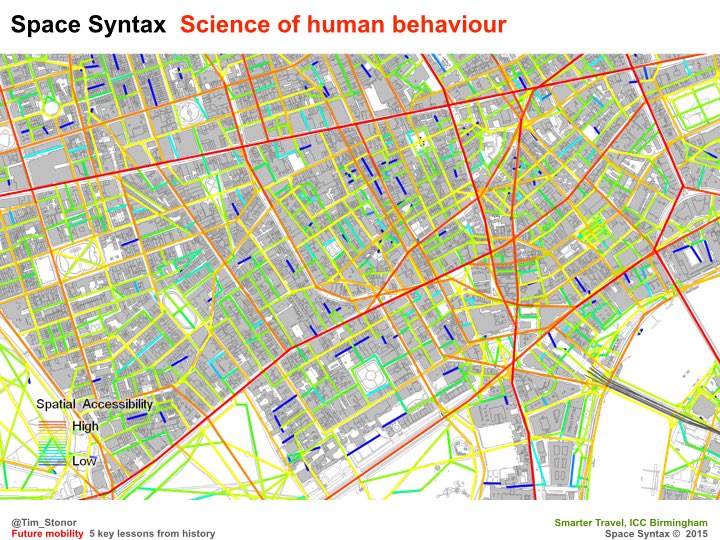
When we apply space syntax analysis to London it suggests it’s not mess at all
That under the apparent disorder, there is a pretty smart city. (more…)
-
Let them smoke ciggies because it keeps them calm
“Cul de sac layouts may be the opium of the unwary – seemingly an analgesic against high-density urbanism – but beware the risks of over-indulgence”.
Steve Morgan, founder of housebuilder Redrow, attacks high-density urbanism in today’s Building Design. He says:
“Build cul de sacs because that’s how people want to live”.
This reminds me of some other things I’ve heard:
“Give them salty food because they enjoy the taste.”
“Let them smoke ciggies because it keeps them calm.”
(more…) -
Moving cities: from transport to transaction
“If the scope of urban policy makers can be widened from a fixation on transport to an appreciation of value-rich urban outcomes, built on the benefits of effective human transaction, then future cities are more likely to be places that meet the expectations of future citizens.”

Cities are ultimately vessels for the concentrated production and sustenance of life. Yet this intrinsic aspect of urbanism – the human factor – is neglected in many future cities discussions, which are instead dominated by the subject of transport and the use of technology to manage existing traffic systems more efficiently. (more…)
-
Forwards to the past! Technology’s greatest triumph

Rick
There are so many reasons why what you have set out below is interesting. But I think I can take a different position to the one that you are developing.
My approach will be that, far from taking the human mind, behaviours, and cultural norms beyond where they have ever been before, the true value of modern technology, analytics and predictive capacity will be for cities and civilisations to recover the unbelievable sophistication that they once had. (more…)
-
Integrated Urbanism – Massachusetts & the United Kingdom Partnership Forum
Introduction
Good afternoon Governor Patrick, visiting delegates and colleagues from the UK. As a recent resident of Massachusetts myself, it is a special pleasure to speak alongside the Governor on the subject of data and cities: and to share some remarks on the common interest in this room: the science of cities.
A few words about me: I am an architect and an urban planner in private practice. My company, Space Syntax is a consulting company that specialises in predictive analytics – using data science to forecast the impact of urban planning decisions – the “what goes where and how does it all connect together” – on urban impacts such as mobility, interaction, wealth, health and personal safety. (more…)
-
Building a Smart City modelling team

.
Cities planning their future are increasingly turning to the production of Integrated Urban Models. These are tools that bring together various datasets on different asoects of urban performance, from the behaviour of people to the flows of energy, water and other utilities. The aim is to better predict the future of cities by better understanding how they are currently working.
This is a nascent but rapidly developing field in which knowledge is emerging and evolving at a pace. Given the complexity of cities it is a good idea to involve many specialists in different subjects, led by an Urban Modelling Advisory Panel (UrbanMAP). (more…)
-
RIBA thinkpiece launched: “A SMART approach to digital planning & design”
The RIBA today launched a set of think-pieces on Digital planning: ideas to make it happen.