Category: Architecture

  • We don’t guess the structural performance of individual buildings so why do we guess the human performance of entire cities?

    We don’t guess the structural performance of individual buildings so why do we guess the human performance of entire cities?

    The structural steelwork of a large and complex building would not be designed without running engineering calculations. Even the smallest of buildings is subject to objective structural analysis. No client and professional team would rely on guesswork, no matter how famous or experienced the architect or engineer.

    So why do we leave the human performance of places to the whim of architects who run no calculations and rely only on their instinct and ego? Why is the science of human behaviour so poorly developed? Why is chronic failure still tolerated?

    In the early sixteenth century, William Harvey challenged the medical profession to take a more objective, more observation-driven approach to the understanding of the circulation of blood. At the time, medical thinking was largely based on the beliefs of Galen of Pergamon, who had set these out in the second century. Harvey challenged a medical mindset that hadn’t changed in one and a half millennia. And he encouraged his peers to embrace advances in science that allowed new forms of investigation.

    We can see a similar state of affairs in the prevalence of, and institutional inertia around, twentieth century planning. Based on belief, not observation-based science, a doctrinal approach to urban planning and design pervades the professions. This is the case, whether the specific approach is Modernism, the Garden City movement or (and especially) Landscape Urbanism. Each is to some degree unscientific.

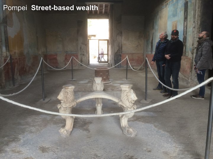
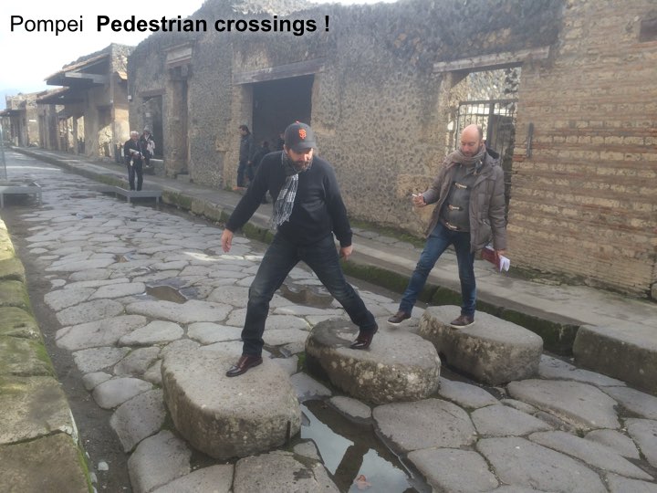
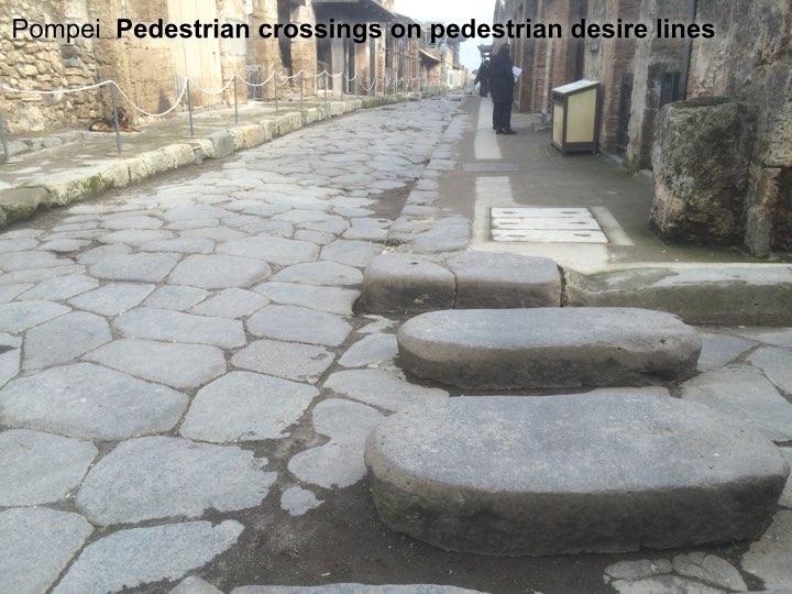
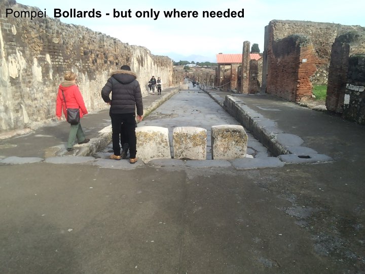
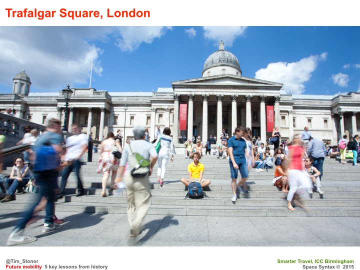
    These approaches propose different kinds of urban outcomes but what unites them is a belief that the future should look fundamentally different to the form of continuously connected, dense and mixed-use urbanism found in cities for as long as there have been cities – the kind of urbanism that architects and town planners visit on their holidays.

    The kind of urbanism – and here’s the irony – that Galen would have recognised. If only architecture and town planning were stuck in a fifteen hundred-year-old mindset. We would still have vehicles on the road but we wouldn’t have vehicle dominance. We wouldn’t have land use zoning that generates long-distance commuting, traffic congestion and negative health impacts. We wouldn’t be encroaching on the rural landscape with semi-detached, density-fearing dwellings.

    Fundamental change in our professions is needed and science has an important part to play. In the spirit of Harvey’s observation-based approach, we need to embrace the new capabilities offered by sensing, analytics and modelling. We need to understand how cities truly work before we then form ideas about how to change them. We must move beyond the beliefs of twentieth century practice. The evidence is there to demonstrate that practice based on belief hasn’t delivered great places with the consistency required either by the investors in them or the users of them.

    We can learn from Harvey, even if our end goal is the urbanism of Galen.

  • Space Syntax in China

    How has Space Syntax been applied in China and are the findings different to those outside China? 

    Space Syntax is not a prescriptive planning and design methodology. Instead it is a culturally responsive planning methodology. It begins by analysing the spatial layout of urban and rural areas and studying patterns of human behaviour, land use and land value. It then shows how spatial layouts influence these patterns. And it allows planners and designers to predict the outcomes of their proposals with greater accuracy than they could before. But it doesn’t prescribe a particular solution. Instead it responds to local cultural differences.

    For this reason I am keen that Space Syntax is used by Chinese people to study and to plan Chinese cities, towns and villages. Only Chinese people fully understand Chinese life. We can train Chinese practitioners how to use Space Syntax tools, but how the findings of the research are interpreted is a different problem. It is a problem best answered by Chinese planners and designers.

  • Sustainable cities of the future – sketch

    Notes for keynote at UK Green Building Council Annual City Summit, Birmingham.

    1. Spatial planning & human behaviour implications of sustainability – reduction of transport carbon through shift towards walking, cycling & public transport

    2. A massive shift needed in transport + land use planning, urban + landscape design, architecture. Professional inertia. Turning the supertanker.

    3. A massive opportunity. Reason to turn.

    4. Lessons from the past eg Pompeii, Brindley Place.

    5. Examples from the present eg Darwin, London SkyCycle, Birmingham Charette.

    6. UK government: Smart & Future cities agenda is a sustainability agenda.

    7. Social inequalities dimension of sustainability.

    8. Need to act at all scales simultaneously ie there’s work for all of us to do.

    9. Challenge for modelling.

    10. Challenge for research.

    11. Challenge for practice: design, development & real estate investment.

    12. Already being acted on. The supertanker is turning.

  • Past, present & future_Space Syntax in practice

    Past, present & future_Space Syntax in practice

    [Speaking notes for Tim Stonor’s opening presentation at the First Conference on Space Syntax in China, Beijing, 5th December 2015.]

    Good morning. It is an honour to be speaking at this important conference alongside so many distinguished speakers and attendees.

    My talk today will cover the past, present and future of Space Syntax Limited’s experience working on projects in London and around the world, including here in China.

    As you heard from Professor Hillier, the relationship between academic research and practice is fundamental. Practice provides an opportunity to apply Space Syntax techniques – and it also provokes new research questions. (more…)

  • Integrated Urban Planning – balancing the multiple flows of the city

    Notes for the UK-China Sustainable Urbanisation Conference in Chengdu, China on 24th September 2015


    My job as an architect and urban planner is to design new towns and cities – as well as new parts of existing urban settlements. This means designing the multiple systems that make up a city. We often think about towns and cities in terms of their physical stuff: their buildings. Perhaps also in terms of their roads and rails. But for me the success of any city can be seen and measured in terms of its flows, the flows of:

    • energy
    • water
    • data

    and, most important of all, the flows of:

    • people: in cars, on public transport, on bicycles and on foot.

    Each of these flows is impacted by urban development: how much of which land uses are placed where, and how they are then connected to each other. Flows impact on other flows.

    Sometimes these impacts are positive, sometimes negative. They have enormous social and economic implications.

    Urban planning is as much about designing flows as it is designing buildings.

    We live in an age of unprecedented computing power – this gives us the ability to better predict the nature of these impacts.

    This is especially important to avoid the unwanted effects of urban development: congestion, air pollution, social isolation and unsustainable stresses on natural resources.

    And computing can help create the positive impacts that are needed to support the essential purpose of cities: to be:

    • machines for human interaction
    • crucibles of invention
    • factories for cultural creation.

    The last decade has seen the emergence of Integrated Urban Modelling. My company, Space Syntax, is a leader in the field: one of the UK companies referred to by the Chancellor as contributing to China’s growth and development. Working, for example, with the China Academy of Urban Planning and Design across China in Suzhou and Beijing.

    Integrated Urban Models link the data generated by the multiple flows and reveal the interactions that help architects and urban planners create sustainable plans. Space Syntax has identified the essential role of spatial layout as the principal influence on urban performance. Spatial analytics are at the heart of our approach to Integrated Urban Modelling and we have made our discovery open source and openly available so that others can benefit too.

    The Space Syntax Online Training Platform is a freely available, web-based resource through which urban practitioners, policymakers and local residents can equip themselves with information and skills to create more sustainable urban futures.

    I’m pleased to announce that this platform is currently being translated into Chinese so that the Space Syntax’s discoveries and experiences can be more readily disseminated here in China.
    _____________

    Integration, balance, glue, pivot: space
    In many ways, urban planning is the integration and balancing of multiple flows. Integration needs glue and balance needs a pivot. Spatial layout provides both.


  • A definition of design

    I believe that a definition of design needs to be more than a list of designers. A list is certainly useful but the definition should also capture:
    – what is designed
    – how design happens.  

    I think a longer – or more dimensional – definition is needed so that designers can better communicate with non-designers who may not understand design and who may therefore be sceptical/fearful/cautious of design – people who may see design as a kind of Emperor’s-New-Clothes-creating hype. 

    Design is a) the creation of b) a proposition in c) a medium, using d) tools as part of e) a process. 

    The nature of each component of this definition may differ between designers:

    b) Proposition

    Visible objects 

    eg building, dress, kettle, car but also 

    Invisible objects

    eg software code, analytic algorithm, policy, process. 

    c) Medium

    Physical 

    eg pencil sketch, 3D model, oil painting, words

    Non-physical

    Spatial

    eg the plan of a building or street grid of a city

    Digital 

    eg computer game, smartphone application, spreadsheet-based model, immersive (virtual reality) architectural model, sound

    Temporal 

    ie designing with the medium of time eg a process: a construction sequence or cash flow model. 

    All the above are different forms of design medium. 

    d) Tools

    Designers will use tools (pencil, knife, keyboard, other people’s opinions) in both:

    Creative and 

    Reflective/analytic modes. 

    e) Process

    Designers will use one or more means of design inspiration and design review, working alone or in collaboration with others. 

    While the nature of b), c) and d) may vary between designers, I believe the consistent ingredient is:

    a) Creation

    Design is innately creative and creativity is a rare and precious commodity that is fortunately found in abundance in the UK – not always buried deep but often sitting right at the surface. 

  • Green space in cities – when more is less

    Tim Stonor‘s response to a study published today, which shows that green space in cities improves the mental development of schoolchildren. 

    I welcome the study: the more we understand cities the better; the Science of Cities – the link between the design of the built environment and the way that we use it – much 20th century planning has been based on guesswork and gut instinct. 

    The UK has recently embarked on a national effort to develop this science, setting up the ministerially-led Smart Cities Forum, the Government Office for Science’s study on the Future of Cities. My own organisation, Space Syntax, is a keen participant in this effort and has been pioneering the scientific study of cities for over 25 years. 

    My concern is not with the study but with how the study might be interpreted by urban planners in the UK. 

    The UK has had something of a love-hate affair: we enjoy visiting Barcelona, Paris, Prague, New York as tourists BUT our efforts to build new cities have given us low density, car-dependent new towns; housing developers continue to deliver this, saying this is what the customer wants; and we believe it. 

    BUT go to Skelmersdale – built on garden city principles with great swathes of open green space – and speak to residents who rely on a taxi culture because there aren’t enough buses – because it’s not economically viable to cover all parts of the town with public transport when the housing is so far apart; or lonely parents in one-car families who are stuck at home because their partner has taken the car to work. 

    Perhaps the most salutary fact is that the study was carried out in Barcelona: high density, mixed use – in other words, not zoned into housing zones, office zones and shopping zones – so people can walk to work, to the shops, to school – this is the sort of place we need more of. 

    And, as Barcelona shows, it can be equally green and highly bio-diverse: street trees and grass verges can provide just as good access to green space as great empty swathes where you might come across more discarded shopping trolleys than people.

  • The Prince of Wales defines the resilient city #DCR15

    3 key features:

    1. Embracing local culture, knowledge and customs. Local understanding. 

    2. Creating places for all types of people to live together – not ghettos. Diversity. 

    3. Integrating people and nature at the centre of the process: urban gardens, parks, orchards & allotments – while protecting rural hinterland. 

    http://www.designingcityresilience.com/

  • The Urban DataFrame

    Context
    The Urban Data Store is a collection of databases on the social, economic and environmental performance of the city. 

    The proposal
    These databases can be organised by an Urban DataFrame. Like threads being organised by a loom. Without the loom they are just threads: disconnected on reels or tangled in a pile. The DataFrame organises and makes sense of the threads. 

    Components of the Urban DataFrame
    The DataFrame has spatial and temporal components.

    The Temporal DataFrame is perhaps the more straightforward. A linear sequence – 1 dimension ie time goes forwards and backwards, not sideways or upwards. Databases are time-stamped, allowing temporal analysis: what happened when?

    The Spatial DataFrame of the City is its street network and building footprints. Being more complex – having 3 dimensions – this is organised configurationally using Space Syntax spatial network analysis. What happened where?

    Benefits of the Urban DataFrame
    In combination with the Urban DataConnector, the DataFrame makes sense if the data threads, finding cause-and-effect associations and correlational patterns within them. This knowledge forms the basis for future evidence-informed urban policy making and planning decisions, the likely impacts of which can be modelled in advance.   
  • City resilience – a definition from history

    City resilience – a definition from history

    Today’s city planners could learn a lot from ancient history when creating resilient cities, says Tim Stonor, Managing Director of Space Syntax.

    In his book, De Architectura, the Roman architect Vitruvius asserted that a good building must have three qualities: “firmitas, utilitas, venustas”. In other words, it must “last long, work well and look good”.

    While the relative importance of these attributes can be debated, what is certain is that together they can deliver resilience. Cities exhibiting strength and stability; that function to the benefit of their citizens; and that are pleasant places to live, work and visit are, by their very nature, resilient.

    Unfortunately, the last hundred years of planning have demonstrated that by abandoning these principles, resilience has been overlooked in city planning. The rise of car ownership in the 20th Century, combined with a desire to zone and segregate, has led to highly disconnected places, particularly in terms of walking and cycling, and removed what is the very essence of cities: human transactions.

    Cities engender collective purpose, deliver great benefits – social, economical and cultural – and drive innovation. This great mechanism, that brings people together, is risked when planning centres around the car. (more…)

  • Pedestrian movement – the forgotten transport mode

    In the field of traffic planning, pedestrian movement is often the forgotten transport mode. But the reality is that pedestrians are the most important mode – because it is when we are pedestrians that we are closest to the places where we make money and spend money; when we are most healthy and, above all, when we are most human.

  • The two types of Smart City technology

    There are two kinds of #SmartCity technology. “Smart at” and “Smart from”. Which is yours?

    Smart at
    Here’s our technology. We developed it for another purpose (often agriculture or aerospace). We’re not sure if it really works in cities but we hear that cities are a big market and we’re prepared to have a pop. 

    Smart from

    Here’s our technology. We developed it through rigorous research on cities: their current conditions and their future needs. We did this because we recognised the importance of cities some time ago. We’re delighted that the rest of the world has now drawn the same conclusion. 

    NB “Smart at” has derivatives eg “We developed this technology for cars because cars were the “be all” and “end all” of urban policy. But now we’re told that bikes and pedestrians are top of the pile so we’re repurposing it and rebadging it for them. We hope it works but we’ve no research to show it does. 

    “There is nothing in the world that some man cannot make a little worse and sell a little cheaper, and he who considers price only is that man’s lawful prey.”
    John Ruskin

  • Urban | Auckland ideas 

    Inspired by Richard Saul Wurman’s presentation at the NZPI Annual Conference 2015 & discussion afterwards. 

    Scales 
    Local places are made by virtue of their place in a wider setting. Squares: it’s not the local design that makes the difference, it’s the connectivity with the wider city that matters. 
    Patterns – common language
    Space Syntax focuses on the common language of space. Seeks to identify the patterns within that language. 
    Future thinking framework
    Climate change
    Resource security
    Demographic change 
    1. Living in cities: live, work, leisure, innovation. 
    2. Governance
    3. Infrastructure
    4. Metabolisms
    5. Urban form
    6. Financing
    7. Technologies
    8. Scenarios – investigating the importance of opposites
    Misunderstood cities
    We don’t understand the complexity and the interdependencies of cities. The Science of Cities is nascent. There’s much to learn. 
    Urban data analyst 
    The job of the century. 
    Geoffrey West
    1. Every city should have a vision
    2. Every city should have great leaders. 
    Comfort
    It’s less about being complacent when feeling comfortable. More about using that feeling to be creative. Mastery. 
    Products. Process. Performance. 
    We tend to focus on the product.
    3 kinds of technology:
    Digital
    Physical
    Ideas
    Technology to:
    1. Analyse
    2. Present
  • Creating a cultural database


    Sir Tipene O’Regan
    Māori indigenous local and world views 

    Notes on the creation of a cultural database using digital technology, presented at the NZPI Annual Conference 2015. 

    “Culture needs to be cultivated.”

    “We must remember to remember.”

    “People who have no memory have no future.”

    Cultural mapping – “Stories of death, lust, more lust & bravery”. Google Earth database of >4,000 names with historic references. Songs, stories too. 

    “We have to be the proprietors of our own cultural database.” This applies equally to any community as it does to the Māori culture that inspired the sentiment. “Something that is authentically ours with an authentic base”.

    “Walk into the future with your eyes on the past.”
  • Attracting new industry to cities – acting beyond the obvious

    I was at a meeting in London yesterday with visiting Chinese national policymakers and was asked what was needed to attract a new industry to a city. 
    This is an important question not only in China but in any country where cities are trying to encourage new business growth. In answer I suggested that there were three important factors that needed to be  in place:
    1. Distinctiveness – the USP of the city – what makes the place special; its climate and its culture. Each city needs to be able to tell its own story. 
    2. Universities and other educational resources – to act as partners to industry to drive innovation and provide a skilled labour pool. 
    3. Great streets and public spaces – after all cities are about human beings needing to move around efficiently and also to enjoy being in the place where they work. 
    Of course other factors are important: a reliable supply of energy and other services; sites that are ready for development and effective legal processes. But these are the obvious consistencies. 
    Cities also need to focus on their story, their academic partnerships and the quality of their public realm: factors that can be neglected in the push to attract new business. 
  • What did the Romans ever do for us? Pompei’s 5 lessons for placemaking…

    What did the Romans ever do for us? Pompei’s 5 lessons for placemaking…

    Download the presentation

    Tim Stonor_Future mobility 15.001

    In looking forwards it is important to learn the lessons of history.

    Look at Pompei. A city built for efficient mobility. 

    A model of the 1st century with lessons for the 21st century. 

    Tim Stonor_Future mobility 15.002

    The grid – no cul de sacs. Built for mobility. Built for commerce. 

    More or less rectilinear – not labyrinthine. A layout that brains like. Easy to wayfind. Hard to get lost in.

    Tim Stonor_Future mobility 15.003

    A Main Street with shops – no inward-looking shopping malls. Active frontages. About as much surface for pedestrians as for vehicles – the right balance for then. Perhaps also for now?

    Tim Stonor_Future mobility 15.004

    And shopkeepers of great wealth! It was not a compromise to open onto a Main Street. It was a sound commercial investment. Who would turn their back on the flow of the street?

    Tim Stonor_Future mobility 15.005

    Pedestrian crossings! The deep kerbs channel water when it rains, flushing the dirt from the road and keeping it clean. Integrated infrastructure.

    Tim Stonor_Future mobility 15.006

    Pedestrian crossings that are aligned with pedestrian desire lines – not following the convenience of traffic engineers’ vehicle turning arrangements. Pedestrians first because its the pedestrians that carried the money, not the vehicles.

    Tim Stonor_Future mobility 15.007

    A small, pedestrian only zone in the very heart of the city. No bigger than it needs to be…

    Tim Stonor_Future mobility 15.008

    …unambiguously signed that this is where you have to get out of your chariot and onto your feet. 

    Tim Stonor_Future mobility 15.009

    Pompei: a city of great streets – great street sense.

    Tim Stonor_Future mobility 15.010

    But in recent times we lost our street-sense. 

    Look at Birmingham then…

    Tim Stonor_Future mobility 15.011

    And now. What happened to our street sense?

    Tim Stonor_Future mobility 15.012

    And Birmingham was not alone. 

    Look at US cities:

    What they were…only 60 years ago – recognisably like Pompei: simple, rectilinear grids.

    Tim Stonor_Future mobility 15.013

    Then what they became…

    We became entrapped by traffic models. 

    And a love-affair with the car. 

    We need to regain our street-sense. 

    Tim Stonor_Future mobility 15.014

    Fortunately this is happening. 

    Trafalgar Square,

    Nottingham.

    Tim Stonor_Future mobility 15.015

    At the Elephant & Castle, this design puts the pedestrian crossings on the pedestrian desire lines – just like those crossings in Pompei. We’ve talen pedestrians out of subways and given them their proper place at street level, next to the shopfronts. We’ve made the humble crossing an object of beauty, spending many different budgets (landscape, planting, pedestrian, cycling, highways) on one project so that each budget gets more than if it had been spent separately.

    Tim Stonor_Future mobility 15.016

    This new approach – a rediscovery of street sense – has been made possible through advances in science that have made us see the errors of previous ways.

    Tim Stonor_Future mobility 15.017

    The more we look into this the more we find of value: for example, how connected street grids create higher property values in the long run.

    Tim Stonor_Future mobility 15.018

    And Birmingham has pioneered this science:

    Brindley Place – the bridge on the straight east-west route – a lesson from Pompeii! It may seem obvious today – because it’s a natural solution – but it wasn’t obvious to some people at the time, who wanted the bridge to be hidden round the corner because, they said, there would be a greater sense of surprise and delight! What nonsense. We had to model the alternatives and show just how powerful the straight alignment was.

    We still have to do so today. Many urban designers and transport planners have been slow on the uptake. The average pedestrian gets it immediately. What does that say for our professions?

    Tim Stonor_Future mobility 15.019

    Now cities all over the world are recovering their street sense, creating plans for their expansion that are street-based, not mall-based.

    Tim Stonor_Future mobility 15.020

    In time to accommodate a new, two-wheeled chariot: the bicycle.

    Tim Stonor_Future mobility 15.021

    SkyCycle – a new approach to urban mobility. Creating space for over half a billion cycle journeys every year. Constructed above the tracks, allowing smooth, predictable, junction-free movement between edge and centre. Developed by a consortium of Exterior Architecture, Foster + Partners and Space Syntax.

    Adding to cycling at street level – not taking it away.

    Tim Stonor_Future mobility 15.022

    Recently, at the Birmingham Health City workshop,a discussion about the location of healthcare facilities quickly became one focused less on hospitals and wards and more on streets and public spaces. On “free”, preventative public health rather than expensive, clinical curative care. Free in that it comes as the byproduct of good urban development. 

    Tim Stonor_Future mobility 15.023

    Rob Morrison’s drawing of the Birmingham Boulevard…

    Tim Stonor_Future mobility 15.024

    …an idea to turn the Inner Ring Road into an active street.

    Tim Stonor_Future mobility 15.025

    And to achieve this there are clear principles to follow:

    1. Connected street layouts.

    2. Mixed mode movement – not separated by tunnels and walkways.

    3. Active streets ie lined with street shops not mall shops.

    4. Pedestrian crossings on desire lines, not where it’s most convenient for traffic turnings.

    5. Limited pedestrianisation of the most important civic areas.

    A thought – yes Pompeii was a city of commerce but the houses of the city are filled with references to literature, poetry, music: the arts. 

    Huge cultural value. 

    After all, this is the important, aspirational aspect of living in cities that comes with the efficient mobility that results from pragmatic planning: the grid, mixed modes, active frontages on main streets and special, limited, high intensity, pedestrian only places. 

    When we get this right we have time to truly enjoy ourselves in the arts and sciences. In culture. That is truly great urbanism.

    Download the presentation

  • Bill Hillier’s Smart London

    Bill Hillier’s Smart London

    Notes of Bill Hilliers opening talk about the NLA Smarter London exhibition, 8th October 2014.

    Congratulations to the NLA and CASA for the exhibition.

    It’s evidence that London is the original smart city – nowhere such a collection of top class practices, imaginative authorities and academic departments developing new ways of doing things, and new technologies –and talking to each other !

    But I think London is a smart city also in another sense – the city itself and how it’s put together.

    When I was young London was regarded as an unplanned mess, in need of being tidied up into a system of well-defined neighbourhood units separated by main roads – a bit like Milton Keynes.

    I’ve been asked to say something about one of the technologies on show – space syntax.

    When we apply space syntax analysis to London it suggests it’s not mess at all

    That under the apparent disorder, there is a pretty smart city. (more…)

  • Building a Smart City modelling team

    Integrated Urban Model

    .

    Cities planning their future are increasingly turning to the production of Integrated Urban Models. These are tools that bring together various datasets on different asoects of urban performance, from the behaviour of people to the flows of energy, water and other utilities. The aim is to better predict the future of cities by better understanding how they are currently working.

    This is a nascent but rapidly developing field in which knowledge is emerging and evolving at a pace. Given the complexity of cities it is a good idea to involve many specialists in different subjects, led by an Urban Modelling Advisory Panel (UrbanMAP).   (more…)

  • From cities of movement to places of transaction

    Summary of Tim Stonor’s talk at the World Cities Summit, Singapore, 3rd June 2014

    From cities of movement to places of transaction – a new mobility focus for city leaders, planners and everyday users

    Key responsibilities for cities
    1. Imagining the future of cities and mobility.

    2. Designing integrated, people-focused planning to sustain cities.

    3. Measuring the social, economic and environmental value created by the movement, interaction and transaction of people.

    The fundamental purpose of cities
    Cities are for transaction: economic and social transaction. People come to cities to trade. It is why we have cities – they are intensifications of opportunities to trade. The public realm of the city – its network of streets and spaces – is where much of this trade occurs: a “transaction machine” which, like any machine, is more or less efficient depending on how it is engineered. (more…)