Slide 1

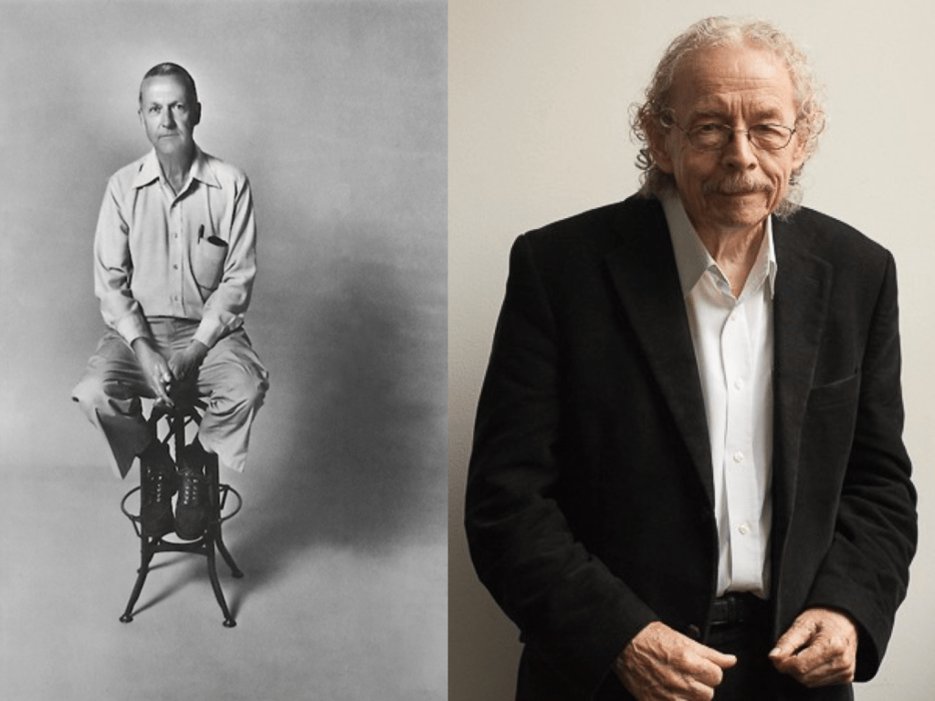
Good evening. It’s a great honour to have been asked to give this evening’s Kevin Lynch Memorial Lecture, and a special honour to be doing so on behalf of Bill Hillier, who is unable to join us. Bill sends his best wishes to the Urban Design Group.
Slide 2

First, I can’t do justice in the time available to the breadth and depth of Bill’s genius. And I use the word genius carefully. I believe, as do many others, that he is a genius.
I may only this evening touch on concepts that each deserve a more lengthy explanation and discussion. And, likewise, on the hundreds of urban planning and building design projects that Bill and Space Syntax have helped create over the past four decades.
But what I hope I will do is paint a picture of Bill’s achievement – albeit a personal one.
I want to talk especially about the future directions that his work is taking. The future is important because Bill is not obviously sentimental. He is far more likely to want to talk about something he is currently working on, or something he doesn’t yet understand, than to dwell on the past. He hasn’t ever, to my knowledge, sought prizes. He’s enjoyed them when they’ve appeared, but he hasn’t gone after them.
And, I suspect like anyone receiving a Lifetime Achievement Award, he has wondered why it was being given so soon, before his lifetime is fully achieved. When I spoke with him last weekend he explained that what he’d really like to be talking about is what he’s currently working on. But, as is often the case with emerging theory, he’s not sure he’s right about it yet. In other words there’s always more to be done.
But Bill was keen to shape this evening’s presentation. So let’s begin with some words from him:
Slide 3

He says, “How we design cities is how we understand them.
By understanding, we mean having some kind of mental model linking the physical and spatial patterns that make up the city to how they are experienced by people and how they work for them.
This may involve spatial ideas, for example about the relation between local neighbourhoods and the city as a whole, and functional ideas, for example about how and where active centres and sub-centres can be located.
Whatever its source, we can think of this as a ‘structure-function’ model.
It will tell us, rightly or wrongly, that if we design the space of the city in this way rather than that, then it will change how the city is experienced and works.”
Slide 4

Bill goes on to say:
“Kevin Lynch took the question of such a model in the direction of science by bringing to light five spatial and physical concepts through which people described the cities they saw: paths, edges, districts, nodes and landmarks.
As he acknowledged, these are not independent of each other, for example edges will normally be the edges of districts, and nodes the meeting of paths. Nor are there argued to be general principles of how the concepts relate to each other to form the city as a whole, other than to exploit these interdependencies.”
Slide 5

“In fact, from the point of view of the city as a whole, there is a remarkably interesting proposition in The Image of the City: ‘The paths, the network of habitual or potential lines of movement through the urban complex, are the most potent means by which the whole can be ordered’. (Kevin Lynch, IC p 96). Compared with this network, he adds, the ‘edges, districts, nodes and landmarks’ are the ‘design of other elements’. p 99. The form of the city, and the interrelating of the five elements, arises from how the network of paths is structured.”
Slide 6

The priority of the path network in cities is shared by space syntax in its attempt to take the question further in the direction of science, by testing spatial forms against observable functions rather than human descriptions.
Space syntax argues that many of the key concepts for understanding the city as a spatial and functional system can be derived from the analysis of the street network. The ‘research question’ posed by space syntax is:
Is there is a formal procedure to describe the spatial structure of the city which both captures its characteristic spatial forms, and maps these onto observable functional patterns with enough rigor to test the link between the two?
Slide 7

That this turns out to be the case is due to the fact that the procedure brings to light a fundamental relation between the spatial structure of the city and its functioning: that other things being equal the key determinant of movement rates in the lines that make up the city is the spatial configuration itself, how each line relates to all the others. We call this phenomenon – of the degree to which movement is shaped by the urban grid – the law of natural movement. Its generality underlies many structural phenomena which are common to most, if not all, cities.
Through this fundamental law, the procedure can, in scientific terms, lead from a structure-function model to a testable structure-function theory of the city, one which could serve both our increasing need for scientific understanding of the city in terms of its economic and social performance, and as a model for use in design.
Slide 8

The procedure generates a set of memorable concepts which summarise the syntactic structure-function theory of the city as far as it has been so far developed, and can be used to define the theory, as Lynch’s five concepts define the view of the city that emerged from his research.
Understand these concepts and you understand Space Syntax.”
So let me, in one slide, try and explain the five key concepts that underpin Space Syntax.
First, is the description of space itself. That it’s possible to break the apparent chaos and complexity of a city’s street network into discrete elements that can then be the subject of computational analysis. In most Space Syntax analysis, the discrete element is the road centre line between one street intersection and the next. This has a length. It has an angular alignment (north to south, west to east or any angle in between); it has a number of connections at each end of it. At one end it may have 0 if it’s a cul de sac. At the other it may have just two or three or more. It has a number of buildings along it. Of different sizes and uses. Data on these buildings can be hung off the line. As can data on the services that flow above or below the line.
Second, and most importantly, is the theory of natural movement, which as Bill just explained, demonstrates that the more connected streets are better used. Connectivity is measured using a computer algorithm that measures how likely it is that people will want to flow down individual streets as they move from A to B. The algorithm calculates all possible journeys using not only the distance as an input but also the complexity of the journey. This is the USP of Space Syntax – most traffic models don’t include complexity in them and, as a result, don’t work particularly well to describe real human behaviour.
Streets that are likely to be well used are automatically coloured red, then orange.
Less well used streets are coloured green then blue.
The concept has been demonstrated now in thousands of studies over several decades. To me it’s one of the most important discoveries in science.
The third concept describes cities as movement economies. In other words, it explains how land uses in the city arrange themselves to take advantage of the natural movement pattern. The shops move to the more connected streets with more natural movement. The houses move, in the majority, to the side and back streets.
The fourth concept, of the simultaneously multi-scale city adds a fundamental description of human life in streets, which is that the activity you see on any street is typically a mix of people moving across longer and shorter distances. The proportion of longer to shorter journeys may vary from the more connected to the less connected streets but it is always, to a degree, there.
Multi-scale movement, and the human interactions that are induced by this, are fundamental to trade. To both social and economic transaction. One of the shortcomings of modern planning has been to overly separate global and local movement – I’ll come back to this later on in this talk.
Fifth, and finally, the concept of the dual grid provides a definition of the purpose of cities. It allows us to distinguish, for any scale of movement, between the foreground grid of main routes and the background grid of minor routes. This is so important a concept that I’m going to quote Bill directly again:
“Finally, (he says) space in cities works in more than one way. The foreground network is structured to maximise movement, and it is so because it is driven by micro-economic factors which benefit from high levels of movement, while the background network restricts and structures movement, and does so because it is driven by social and cultural factors which find expression in the way residential space is structured. So the dual network in cities reflects functional as well as spatial processes
This is an instance of the more general potential of space to operate in two ways. Space can be use generatively to create new patterns of movement and so co-presence and potential relations in the social system, or it can be used conservatively to express and so reproduce existing social patterns and structures. The former is associated with spatial integration, the latter with spatial segregation.
The difference between the foreground and background networks is the difference between more morphogenetic and more conservative space. The former focuses movement to create development and change, the latter diffuses it to keep things as they are.
This generic structure seems to underlie all cities in some sense, and we must conclude that beneath the individuality and cultural typing of cities, there is a universal generic city which makes the city what it essentially is.
All societies must in some sense be morphogenetic in order to cope with changing technological and social circumstances, and all societies must also act in ways that reproduce their structures – hence the dual use of space
Cities are spatially massive morphogenetic machines that produce change, set into a conservative background which stabilises their structure. This is the generic city. It was I believe the discovery of the generic city that first made urban societies possible.”
Slide 9

At the heart of the Space Syntax approach therefore is a desire to understand and then design for both thriving life and societal stability.
Plenty of action on the foreground grid of main streets and in the centres: social and economic interaction, transaction and innovation.
Quiet repose in the background grid of mainly residential streets.
If we can look beyond the clever computation, what matters is thriving life.
However, in many space syntax presentations, a wash of technical analysis has sometimes obscured the key cultural messages; too many graphs and too few statements of fundamental “so therefore” importance.
Now I think this is forgiveable in a young discipline trying to find its way in a hostile context – confronted at every turn by the architectural establishment, by the Home Office, by the transport planners.
It’s far easier in such circumstances to withdraw and to talk the secret language of the clique than the common language of the crowd.
And it’s also understandable that, in academic circles, Space Syntax needs the esoteric rigour of scientific debate.
But the discipline is no longer in its teenage years and the needs of cities are more than academic.
Space Syntax is mature now, and needs, I believe, to have its voice. The context is no longer hostile – to the discussion of space, connectivity, place, people, walking, active frontages. The 1980s and the 1990s are no more – and in an increasingly urbanising world in which car-centric paradigms still dominate, science is needed, more than ever, to make sense of the pace of change in global urbanism.
As one of the few scientific efforts to explain cities, space syntax has a special responsibility.
And we will all do well by learning from Bill. There has been no better person in my experience at presenting Space Syntax to a non-academic audience.
Slide 10

Go and watch his piece for Tomorrow’s World in 1993:
https://www.youtube.com/watch?time_continue=2&v=9FY7ImqYsm8
Slide 11

…where you’ll see Bill discussing spatial connections with a group of residents who understood exactly what he was saying…
Slide 12

…who understood that not all upper level walkways were automatically bad.
Space Syntax was accelerated through engagement like this: at Limehouse Basin in the early 1980s.
And shortly afterwards at Coin Street.
Standing up to development that was recognised locally as being wrong for people. Wrong for local communities. Providing the evidence of science to build a better case to object.
Then, later, not only to object but to propose. To help design places for people.
Slide 13

Space Syntax has been involved in some of the most important projects in the UK, such as the redesign of Trafalgar Square…
Slide 14

…where we explained why the old design didn’t work – first through observation, then through the construction of a spatial model that showed why people walked around the edges of the square because the routes were more spatially convenient.
This diagnosis produced a creative idea from Bill – to build a new staircase in the centre of the square. Our modelling showed how this would have a major positive impact on pedestrian flows. Bill shared his idea with Norman Foster and the rest is history.
Slide 15

Of all the architects we’ve worked with, Norman Foster seems to understand Space Syntax best:
“I know that these techniques work from the tough environment of practice. I love the work of analysis, observation, of research but also passion, imprecision, the hunch. Space Syntax is the testing of the interaction of these opposing worlds.”
Slide 16

To Foster, Space Syntax is not a set of pretty – if complicated – pictures to post-rationalise preconceived design ideas: a techno-wash to bamboozle the uninitiated. Instead, it’s a design tool that mediates between rational science and artistic emotion.
Slide 17

I can say this with confidence because I’ve seen it first hand since joining Bill’s consultancy work at UCL in 1992. And currently, working with the Norman Foster Foundation on this project to expand London’s cycling capacity with another 500 million cycle journeys a year. Not to remove it from street level – as was cynically assumed – but to add to it.
Slide 18

Whether at the fine scale of Trafalgar Square, or Broadgate, or Old Market Square in Nottingham – or the large scale of SkyCycle, Space Syntax was conceived as a tool to facilitate design. To take the guesswork out of it.
Who wouldn’t want some of that?
Slide 19

I think it’s fair to say that much of what we’ve done has been behind the scenes…as in the creation of the Queen Elizabeth Park for the London Olympic and Paralympic Games.
Slide 20

…where Space Syntax helped to shape the design for the Olympic Park masterplan so that it made connections with those communities to the west and east. This means that the park remains an active part of the city today.
Slide 21

In London today, as in many other places, the Space Syntax approach is being quietly used on a wide range of projects.
Slide 22

And sometimes more prominently, such as here in Darwin, Australia, where we worked with the Lord Mayor and her team of advisors – including long-term Space Syntax collaborator, Steve Thorne – to create a plan that doubles the size of the city centre in a way that will create new, street-based urbanism with enhanced land values.
Slide 23

A masterplan was developed for the city through a process of design workshops. During these workshops, a Space Syntax model was run to “live test” emerging ideas.
Slide 24

A final masterplan was produced, creating a new network of streets and spaces that integrates with the existing city.
Slide 25

This plan has been analysed using the Space Syntax model to make sure that strong connections were made into, and through, the new developments and that a set of quieter, less well connected streets was created. In this way a hierarchy of connections was produced to accommodate the movement needs of different land uses: busier commercial streets and quieter residential streets, only a turn away from each other in the manner of traditionally connected street grids.
Slide 26

The foreground grid and the background grid making it from theory into design practice.
Slide 27

An UrbanValue model was constructed, using Space Syntax analysis as a key input. This model identified land value increases of at least 3.7 billion Australian dollars.
We’d never produced a model quite like this before. Just as we’d never quite produced a fine-scale pedestrian movement before
as we did for Trafalgar Square. One key lesson from practice is that it provokes research. If you organise it correctly, the studio can be as fertile a research environment as the university.
Not everyone in traditional academia agrees with this – or wants to agree. But it’s true and it’s one of the reasons that Bill engages so closely with the company. It’s not to make money. It’s to make ideas.
Slide 28

But that’s not to say we don’t work closely with academia. Far from it. For example, the UCL-led Urban Buzz project gave us an opportunity around ten years ago to develop Bill’s controversial research into burglary. To finesse his findings about the importance of spatial layout.
It’s a complex explanation – not for today’s presentation – but, in summary, better connected streets, such as those on the left, can reduce the lifetime costs of an area whereas less connected layouts can increase them. But only when other factors are in place too – such as being able to see several front doors from your own, rather than a few or none.
Slide 29

Armed with this knowledge we can help to address the UK’s housebuilding challenge, designing urban extensions that integrate with existing places.
Spatial accessibility modelling provides an evidence platform to test proposals on.
Slide 30

In this plan, Space Syntax has helped to design a street layout that creates a dual grid: a few main streets for the shops and a hierarchy of medium to less well connected other streets for non-retail and residential uses.
High movement on the main streets where we want it and sufficient movement on the side streets to provide “natural surveillance” that facilitates safety.
Slide 31

And being careful not to create unwanted movement through places where it isn’t wanted such as this quiet village.
Slide 32

By toggling between before and after analyses we can see that the spatial hierarchy is barely altered – the only real difference being the creation – deliberately – of a walking and cycling route northwards out of the village.
Slide 33

Elsewhere in the world the challenges are different and, arguably, far more important.
About a third of the population of the City of Jeddah lives in unplanned and informal settlements. But if you’re a wealthy car driver you might hardly notice them.
Here’s the route hierarchy, calculated for journeys of around 10km, the model picking out in red those routes that are more likely to be selected by people moving at this scale. Analysis which of course can be verified by correlating the output of the spatial model with actual vehicle counts.
Perhaps unsurprisingly the model highlights the motorway network of the city.
Slide 34

What’s even more interesting is when you dial the model back to journeys of around 800m. It’s here that the unplanned and informal settlements leap out.
Jeddah is two different cities in one. The car city, set apart from the foot city. It’s quite unlike London, or Pars or Rome or Vienna or Manhattan or Tokyo or Shanghai or many other world cities, where local and large-scale movement co-exists on the network of main streets boulevards. In Jeddah, the traffic engineers have been so successful as to render the boulevards sterile.
Slide 35

This diagnosis of Jeddah’s spatial dislocation helped us to create redesign proposals that target the key links that are needed to stitch these locally connected places into the wider city. To open them up without destroying their local character. To allow them to trade outwards as well as within themselves.
Key to this was the design of the outer perimeter – making it more of a trade-friendly boulevard than an impenetrable ring.
Slide 36

But it isn’t just unplanned settlements outside the UK that need spatial surgery. Closer to home a number of recently planned New Towns – planned by the nation’s finest – have recognised limitations in their spatial structures, their land use dispositions and the resulting patterns of socio-economic activity.
In every case the diagnosis is the same: a spatial dislocation between the foreground and the background grid. Not the continuously connected dual grids of history but something quite different – and damaging.
Made even more challenging by the fact that the disconnective tissue – the stuff that separates foreground main streets from background residential streets – is not only the car-centric highways network, but it’s landscape too. People’s lives are stifled by green.
Slide 37

If there is one spatial condition we see most often – it is the overly fragmented city of disconnected developments.
Or, we might soon need to say, the overly fragmented corridor of disconnected garden villages.
What history offers is a different model: the integrated city of continuously connected neighbourhoods. Where you can walk between one centre and another without ever realising when you’ve passed from one neighbourhood to the next.
Because the edges of neighbourhoods are not defined by a highway or an overly wide landscape swathe, but by what Bill calls the “fuzzy boundary” of residential streets.
Green streets, with trees, hedges and verges. But streets all the same.
And this is not about environmental compromise. It’s the opposite. The ecologists tell us that cities of continuously connected green streets are ecologically more diverse than the countryside.
Slide 38

So we need streets, large and small. Green streets. And continuously connected grids of streets with occasional, exceptional parks and open spaces. Not patchwork quilt-like pseudo-cities or disconnected village systems.
The key element of urban design is still the continuously connected network of streets.
Slide 39

Aside from what we might call the conventional uses of the approach – to support the planning and design process – Space Syntax is being used in a number of innovative ways and I’d like to share a few.
For example, we have used spatial layout modelling to speculate how a failure of London’s flood defences would impact on the large-scale movement patterns of the city.
I think we all know intuitively that the loss of bridge connections across central London would devastate communications. But how precisely? And what would the new route hierarchy look like?
Slide 40

Spatial accessibility modelling allows us first to identify the likely concentrations of people and also the key movement channels they are used to taking day to day.
Slide 41

We can then remove those connections that are taken out by a flood.
As you can see, London’s movement patterns change entirely.
This analysis can inform emergency response planning as well as evacuation control.
In the longer term it can help prioritise the repair and reopening of movement corridors.
We can of course make an even more sophisticated analysis by loading up each location with the precise land use mix and density of buildings as well as the location and capacity of transport routes: bus, tube and train. Which is in fact what we do.
But, first it’s important to understand what space alone would do. After all, come the flood, all we might be left with is the space.
And similar principles apply to any major urban event and consequent evacuation.
Slide 42

As happened in Christchurch in New Zealand following the earthquakes of 2011.
Christchurch is a city built on a historic grid that, as you can see from the pattern of red, highly accessible routes, diffuses movement between north and south, west and east.
The greatest concentration of these routes is at the very centre, supporting Christchurch’s retail and business centre, the greatest concentration of commercial property in the region.
Slide 43

The earthquakes devastated this very centre, resulting in the closure of the entire CBD for four years.
Christchurch had to adapt quickly or suffer catastrophic economic failure.
Two things are worth pointing out:
– first, the continuously connected grid layout of the city was key to the city’s survival, providing as it does a choice of routes so that movement could immediately adapt to road closures. Contrast this with cities that have increasingly funneled their traffic onto a limited number of major highways. When one of those goes down the whole might easily go with it
– second, the emergence of new centres such as that circled, Stanmore Road. It was to new as well as existing peripheral centres that businesses relocated.
Modelling helps cities plan for their long-term recovery as well as their short-term evacuation and relief efforts.
Slide 44

Some events are short-lived and can, at the time, appear random and chaotic.
For example, the London Riots in 2011.
We looked at the time – indeed while the events were unfolding – at what was happening where, using media sources to map the riot instances.
Slide 45

We then ran analytics on these locations.
First, we can see that 84% of the incidents occurred in areas with higher than average Index of Multiple Deprivation.
This is a start but it doesn’t explain why certain areas with high IMD scores saw higher levels of rioting and some didn’t see any.
Slide 46

By zooming in and looking in a more granular way we then identified that most incidents occurred in more accessible streets.
This is helpful but of course that’s where the shops are, isn’t it?
And why didn’t some high streets suffer?
Slide 47

Once we add a further layer of analysis, a clearer picture emerges.
We looked at the proximity of rioting incidents to clusters of densely connected but spatially inaccessible streets – these are typically post-war housing estates. And we saw that every single incident occurred within 800m of both a high street and an estate.
Now precisely why this should be the case is open to speculation and further research. Did the rioters live or socialise in these estates? Or is this just coincidence and is there another explanation?
These are questions that can now be asked.
Slide 48

And though I don’t have the time today to go into it, our work at Space Syntax is increasingly about the movement and behaviour of people inside buildings, where spatial analysis software has been developed to understand, then to predict, the fine-scale behaviours of people in retail environments, in offices and in museums & galleries as here at the Old Tate Britain, where:
– on the left you can see the actual pattern of movement created by 100 people in their first ten minutes (we know this because we followed them)
– and on the right you can see a spatial accessibility analysis based only on the floor plan of the building and demonstrating, once again, the fundamental role of space in shaping human movement and encounter.
Slide 49

So let me try and summarise what we’re doing at Space Syntax.
We’ve built an organisation around the central idea of creating and then nurturing thriving life. However our clients and partners approach us, this idea is common to their interests.
We wrap the idea in a process that has two key characteristics: it’s science-based and it’s human-focused. When I asked Bill if he could describe Space Syntax in one sentence he reduced it to these four words: science-based and human-focused.
Then, as you’ve seen, there are three principal kinds of activity that we undertake:
– first, we apply the approach in practice
– second, we develop it continuously to keep pace of change: new data sources, new computing capabilities and, most of all, new kinds of questions from our clients and partners
– third, we disseminate it. This is possibly the most important one of the three. And it’s where I’ll end in a few minutes.
But first a quick tour of the other two. We apply Space Syntax through the Consultancy and the Studio streams of our company.
Slide 50

The Company supports other designers in the creation and testing of design proposals, for example the recently opened new headquarters of Bloomberg in the City of London, which incorporates a street on the ancient alignment of Watling Street.
Slide 51

The idea of recreating this street has been around twenty years in gestation. it emerged from analysis of the surrounding street network. like the staircase at Trafalgar Square the idea is obvious once it’s drawn. But no one had drawn it until we did. And then spatial modelling has helped convince decision-takers that it is an idea worth having.
As well as working with individual developers, Space Syntax has also constructed a Pedestrian Movement Model for the whole of the City of London. In a few years I would expect any serious economic centre to have one of these.
Slide 52

Alongside the Consultancy, the Space Syntax Studio prepares designs for public and private sector clients, acting as the lead designer in multi-disciplinary teams.
This is an important development for Space Syntax…
Slide 53

…It’s one thing to offer your ideas as a consultant. It’s another responsibility altogether to marshal the team’s collective thinking into a singular proposition. And so we have hired carefully to make this possible.
Slide 54

And at the heart of the operation is a project review process that Bill and I co-chair.
Slide 55

Where projects are seen through from inception to completion.
Slide 56

We develop the Space Syntax approach through two further streams of activity.
First, the research Laboratory – you’ve seen its work on flooding, earthquakes and other issues just now.
Second, the DigitalWorks, that develops technology we try out on research projects and then implement in the Consultancy and Studio work.
Slide 57

Both the Laboratory and DigitalWorks streams are currently engaged in work we’re undertaking with the Future Cities Catapult to create a new, open source piece of technology to connect datasets.
To do so we’re actively looking at health inequalities – including, for example, the phenomenon of loneliness that is associated with car-dependence, which in turn is directly affected by spatial planning. We’re bringing together the fields of health, transport and urban design to understand the correlations and associations between datasets that are traditionally held apart.
This has important implications for professional practice and, we believe, a disruptive potential that the urban design profession must learn to master if it is to remain relevant.
Slide 58

The decisions taken by urban designers have profound impacts on people’s lives.
The datasets that are becoming increasingly available – and the computing power that is now with us to drive the analysis of the datasets – means that, if we know where to look and how to look – we can say far more than we have ever been able to.
For example, as in this slide, about urban morphology, car dependence and how this affects people’s ability to seek work.
By showing how traditional transport planning practice is locking in inequalities – is hampering social and economic mobility – we as urban designers can make a powerful, evidence-rich contribution to the debate about place. Why connectivity matters. How much connectivity is enough and even when too much is harmful.
Slide 59

We can argue for walkability. Not as a nice to have. But as a must have.
Slide 60

We can engage in the debate about healthcare provision. First, in terms of its location and second, in terms of its quality.
We can help patients have a voice by visualising and analysing their feelings. Relating them to place. Bringing the spatial dimension into conversations that are ever the richer as a result. Inserting spatial analytics into policy debates. Spatialising social and economic phenomena that are otherwise impossible to understand. Or simply misunderstood.
Slide 61

We don’t claim to have all the answers. But we have an approach that helps unpack complex problems and we’re always looking for the next challenge.
Slide 62

But Space Syntax can’t do all of this alone. And we don’t want to.
And this brings me to the final subject of dissemination. This is what really matters to Bill, to me and to all of us at Space Syntax.
We want nothing less than for everything we have created to be available to general practice.
Our theories. Our software. Our methods. And our data.
Slide 63

None of this is new. One of my challenges when I took on the running of the Space Syntax company in 1995 was that almost everything we’d done, every spatial calculation we’d made, had been published. There wasn’t really any IP to protect. The theories were all accessible. They’d been published first in The social logic of space in 1986 and they were about to be published in Space is the machine in 1996.
And so one of the first decisions we took was to make it even easier for people to get their hands on Space Syntax software.
And likewise with data. If academic researchers asked then we obliged and licensed our spatial models and our observation sets for free. For non-academic clients we charged them.
As for our methods, well that’s a different story. Not only because we felt then that our methods were the secret sauce worth protecting. But also, and perhaps more importantly, because the methods themselves were going through a period of immense upheaval. Whatever we published one week would have been obsolete the next.
Now I can say with unprovoked candour that this is not perhaps the simplest way to grow a company. To undergo seemingly endless reinvention. We could have stuck with a method that we knew did the job well enough. The good old axial map. Axman software – for those of you who remember it.
But we just couldn’t. Because we knew in our hearts it was the wrong thing to do.
Any technology-based organisation that doesn’t continuously evaluate itself and renew its technological capabilities is creating its own demise.
And Bill never lets that happen.
Slide 64

In the last ten years ago we have ramped up the process of dissemination.
Key to this was the open sourcing in 2009 of the Depthmap software created by the late Alastair Turner. Knowing he was dying, Alastair wanted to create a network of fellow coders who could continue to work on the software after his death.
This was a huge commercial issue for us to get our heads around. And, tragic as the circumstances were for his decision, I’m so grateful for the fact that he made this happen.
Ten years later, we see no evidence that opening up the source code of our software has damaged our business. Nor the 50,000+ downloads that have occurred. Far from it. Space Syntax is better supported and better known, which is only for the good. It is a great legacy.
***
Two years before the open-sourcing of the Depthmap software we published Space is the machine online – for free.
Slide 65

We did this because the original publisher didn’t want to reprint it – at least not without a monumental effort – and we could see copies being traded on Amazon for over $250. None of this seemed right.
Go to http://spaceisthemachine.com for your free copy.
Slide 66

We’ve recently added a web interface to make it easy to dip between the chapters.
Or you can pay to have it printed, bound and posted to you. It’s delightful how many people do. We receive a cheque every quarter and this is building a small fund that we will reinvest.
Slide 67

And in 2015 we published the Space Syntax Online Training Platform. Our secret sauce. Our methods – how we bring it all together: theory, data and analysis.
Please take a look and tell us what you think:
Slide 68

We created the Online Training Platform because we knew from the beginning that opening up our software wasn’t enough. We also needed to release the operating manual.
By the way, we’d have done it sooner were it not for the Global Financial Crisis which, like a slap in the face set us back several years. I’m sure I’m not the only one in the room who can say that.
Slide 69

And we’ve translated the entire site into Chinese.
Slide 70

Because the demand from China is huge. I think it may not be an exaggeration to say that there are now more Space Syntax researchers and practitioners in China than in the UK. Perhaps more in China than the rest of the world combined.
Slide 71

To this end we have started an annual Chinese Space Syntax conference – now in its third year. Five hundred people came to the first one, with barely any advertising.
It’s entirely appropriate therefore that the next International Space Syntax Symposium will take place in Beijing in 2019.
Slide 72

To anticipate and to nurture this growing demand, we established Space Syntax China four years ago. As well as undertaking consultancy and studio work, we are putting a big effort into dissemination through training.
We recently trained a group of professional planners at the Changchun Institute of Planning and Design. They will be starting their second year of training in January.
Slide 73

Just in case you didn’t notice the blue words around the edge of the circle, our business approach can be summarised in three phrases:
– open source
– open access
and finally, at the top there, employee-owned.
Slide 74

Three years ago we opened up the ownership of the company to everyone that works there. From day one of their employment.
A city is not a tree. At least it shouldn’t be. It should be a grid. And so with a business. Not a single trunk, a few branches and lots of twigs. But instead a multisystem. Many brains. Reflective decision-making.
Slide 75

And through being open – with our core software, with our methods and with our data.
We believe the way forward is to make available everything we know about how towns and cities work.
Slide 76

With this in mind, I’m pleased to announce today that we will soon be launching – freely and openly – the spatial layout model of central London on which so much of the work I’ve just shown you has been based. This has been constructed over many thousands of hours and millions of pounds of public and private money.
We could choose to keep it to ourselves but we think it’s better to make it a public asset.
In fact we’re not restricting the release to central London; we’re including the entirety of London within the North and South Circular Roads
And within the M25.

But why stop there. Through first the Urban Buzz project and then some work for the UK Government Office for Science we have constructed a spatial layout model of England, Wales and Scotland.

We are working with the Future Cities Catapult, the Centre for Cities, the Core Cities Network, the Ordnance Survey and a number of other partners to embed the model in economic and social analysis and policymaking.
To place space and spatial analysis where we believe it belongs. Or rather, where the science of Bill Hillier shows it belongs:
– right at the heart of things.
Thank you.

Leave a comment